The United States is experiencing a series of unusual weather patterns occurring simultaneously, including extreme heat, smoky air, and tropical storms.
Specifically, there are tropical storms in Hawaii, record high temperatures across the Sun Belt states, and poor air quality in many areas due to smoke from wildfires in Canada drifting across the border.
While the U.S. and China, the two largest polluters in the world, are working towards an agreement to cut carbon emissions, Americans are enduring extreme weather events that scientists believe could become more common due to climate change driven by fossil fuel use.
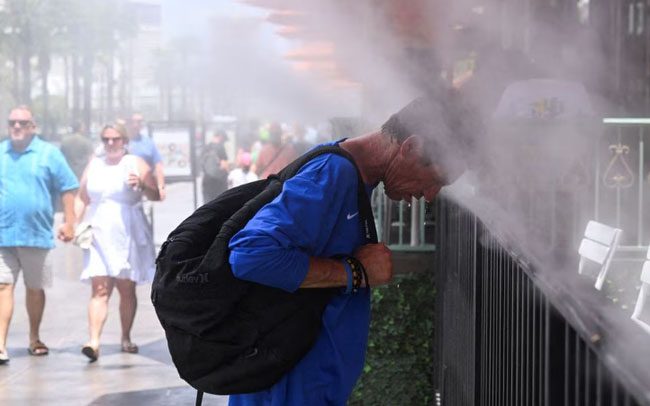
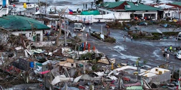
Weather in the U.S. is quite unusual. (Photo: Reuters).
Here are some noteworthy weather phenomena impacting the U.S. on July 19:
Record Heat Waves in Arizona
A massive heat dome over the southern and western U.S. is causing tens of millions of people to face extreme heat warnings. In Phoenix, Arizona, temperatures on July 18 exceeded 110°F (43°C) for the 19th consecutive day, breaking the previous record of 18 consecutive days above 110°F.
The state of Arizona reported that electricity demand reached an all-time high of 8,191 megawatts (MW) on July 15 due to the heat. Central Texas, an area stretching from north of San Antonio to Dallas, is forecasted to experience temperatures reaching 105°F (approximately 40.5°C) or higher in the next two days.
The hottest spot in the U.S. on July 18 was expected to be Death Valley, California, where temperatures in Death Valley National Park were expected to reach 122°F (50°C). The all-time high temperature in Death Valley is 134°F (56°C), which is also the hottest temperature ever recorded on the surface of the Earth.

The massive heat dome is causing extreme heat warnings. (Photo: Reuters).
Poor Air Quality
Smoke from wildfires in Canada continues to spread across the U.S., leading to harmful air quality on July 18 in remote areas such as Yosemite National Park (California), Conway (New Hampshire), and Great Smoky Mountains National Park (Tennessee), according to AirNow.gov, which tracks pollution levels.
Stan Benjamin, a senior research collaborator at the National Oceanic and Atmospheric Administration, stated that winds at altitudes of about 10,000 to 15,000 feet (3,048 to 4,572 meters) and other weather patterns could carry smoke as far as 500 miles (over 800 km) in a day, dispersing smoke widely across the U.S.
Tropical Storms and Flooding
The National Weather Service (NWS) announced that the Big Island in Hawaii was under a tropical storm warning early on July 18 (local time) as the area prepared for Tropical Storm Calvin, expected to bring up to 8 inches (over 20 cm) of rain and gusts of 40 mph (64 km/h).
Nearly 5,000 miles (8,046 km) northeast, in Vermont, flood warnings were in effect for central areas of the state, including the capital Montpelier, which was submerged due to rising waters following heavy rains last week.
The NWS reported that thunderstorms on the afternoon of July 18 could produce rainfall of 1 to 2 inches (2.54 to 5.08 cm) per hour in the area, where the ground conditions were already saturated, increasing the risk of flash flooding.
