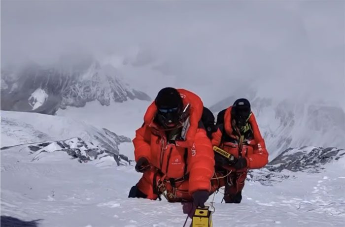
According to a study by a Chinese scientific team published in the nonprofit international journal The Cryosphere on July 6, researchers from the Tibetan Plateau Research Institute of the Chinese Academy of Sciences revealed that the average snow depth on Mount Everest is approximately 9.5 meters—significantly deeper than previously known.
This discovery could completely change the understanding of climate change at extreme altitudes.

Scientists from the Tibetan Plateau Research Institute shared results from their expedition last year. (Photo: The Cryosphere)
Previous estimates placed the snow depth between 0.92 to 3.5 meters, but acknowledged that these measurements were inconsistent and lacked reliability.
“Our measurements reveal an astonishing average snow depth at the summit of about 9.5 meters, much deeper than earlier estimates,” said Professor Yang Wei from the Chinese Academy of Sciences.
This result is based on tests conducted during the expedition in April and May of last year. They employed ground-penetrating radar to record data along the northern slope of Mount Everest at altitudes above 7,000 meters.
According to the report, 26 measurement points concentrated at the summit indicated an average snow depth of about 9.5 meters; however, it was also noted that this result could vary within a range of plus or minus 1.2 meters.
The results also highlighted a distinct difference between the snow surface and the underlying rock, allowing the research team to delineate the boundary between these two materials.
“Such uniformity not only demonstrates the reliability of the repeated radar measurements in this limited area but also provides insights into the relatively flat terrain along the slopes of Everest,” the report stated.
Professor Yang noted that previous measurement efforts were constrained by factors such as “snow density, the length of measuring stakes, and challenges related to altitude.”
In the article, the researchers stated that comparing snow depths across different periods could be beneficial in understanding the impact of human-induced climate change at extreme altitudes in the Himalayas.
“Snow and glaciers on Mount Everest are agents of climate change; thus, these factors provide a potential natural foundation for us to better understand how ongoing climate change manifests at extreme altitudes, as well as their widespread effects,” the report emphasized.
Chinese experts suggest the need for snow core drilling and additional ground-penetrating radar measurements on Mount Everest to investigate trends in snow changes at this altitude.
One of the significant findings of this experiment is the discovery of discrepancies regarding the exact height of Mount Everest. Due to variations in snow levels, gravitational anomalies, light refraction, and several other factors, the actual height of the peak may differ from previously known measurements.
Mount Everest is the highest peak of the Himalayan mountain range, but the maximum height of the peak remains inconsistent.
In 2020, Beijing and Kathmandu jointly announced the latest measurement of 8,850 meters, slightly higher than Nepal’s previous measurement and about 4 meters higher than China’s estimate at that time.


