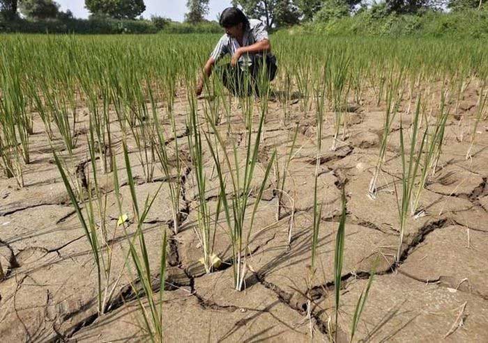
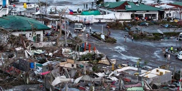
Most of the hottest years in history have occurred during El Niño events. Scientists are concerned that this summer and the next could witness record temperatures both on land and at sea.
Increased Risk of Heavy Rain and Drought
El Niño, which leads to higher-than-average sea surface temperatures in the central and eastern Pacific near the equator, has officially emerged, according to scientists at the National Oceanic and Atmospheric Administration (NOAA) in the United States. This weather pattern last occurred in 2018-2019 and typically happens every 2-7 years.
Depending on its intensity, El Niño can have various impacts, such as increasing the risk of heavy rainfall and drought in certain locations around the world. Climate change may exacerbate or mitigate some specific effects related to El Niño. For instance, El Niño can lead to new temperature records, particularly in regions experiencing above-average temperatures during these events, according to NOAA.
This week, Australia warned that El Niño would bring hotter, drier days to a country prone to severe wildfires. Meanwhile, Japan reported that the developing El Niño is part of the reason for the warmest spring on record in the country.

El Niño officially increases heat and drought.
Most of the hottest years in history have occurred during El Niño periods. Scientists worry that this summer and the next may see record temperatures on land and at sea. The last significant El Niño event occurred in 2016, following a three-year period during which the world was affected by the cooler La Niña phenomenon.
During that time, many countries and continents recorded a year of unprecedented heat. This year, meteorologists believe that El Niño, combined with warming due to climate change, will force the world to contend with record high temperatures.
Furthermore, when El Niño occurs, sea temperatures in the eastern Pacific are warmer than normal. Given the current situation, where the global average sea surface temperature in May was about 0.1°C higher than previous reports, more extreme weather is expected.
Commenting on this, Michelle L’Heureux, a meteorologist at NOAA’s Climate Prediction Center, stated that we are in an unprecedented situation. A study published in May in the journal Science suggested that this year’s El Niño could result in global economic losses of up to $3 trillion, impacting GDP, production, and agriculture, and particularly accelerating the spread of diseases.
Impact of El Niño on Vietnam
According to the National Center for Hydro-Meteorological Forecasting, El Niño is a natural climate pattern resulting from unusually warm waters in the eastern Pacific. The term El Niño refers to the phenomenon where sea surface temperatures in the central and eastern equatorial Pacific (characterized by the Nino3.4 region) are at least 0.5°C above the long-term average (LTA), typically lasting 8-12 months, with a recurrence rate of about every 3-4 years. The average sea surface temperature anomaly in the Nino3.4 region for the three-month period of February-March-April 2023 was 0.2°C below the LTA, but it has continued to rise compared to the three-month period of January-February-March 2023, which was 0.2°C higher. In the first week of May 2023, sea surface temperatures in the Nino3.4 region increased and are currently 0.4°C above the LTA.
The National Center for Hydro-Meteorological Forecasting indicated that under El Niño conditions, most regions in the country are expected to experience higher-than-normal average temperatures; heatwaves may occur more frequently and intensely; there is a likelihood of setting new records for absolute maximum temperatures; while the activity of storms/tropical depressions may not be frequent, they will be concentrated in the middle of the season, exhibiting more irregular characteristics in both intensity and trajectory.
It is noteworthy that El Niño often causes rainfall deficits across most of the country, typically ranging from 25% to 50%; thus, there is a high risk of localized or widespread drought in areas with high water demand for production and living needs during the dry months of 2023. Care must be taken to mitigate the effects of little rainfall leading to drought, saltwater intrusion, and water shortages in the early months of 2024 nationwide. A clear example of the impacts of El Niño is the record droughts caused in 2015/2016 and 2019/2020.
Statistics show that, on average, 5-7 tropical cyclones (including storms and tropical depressions) affect our country each year, averaging 0.58 per month. In El Niño years, the average is 0.42 per month, about 28% less than the LTA. Additionally, under El Niño conditions, tropical cyclones tend to concentrate in the middle of the storm season (July, August, September).
In El Niño conditions, the average temperatures of the months are generally higher than normal, with winter showing a clearer difference than summer, and southern regions being more affected than northern regions. Strong El Niño events can lead to many records for absolute maximum temperatures in various locations.
Typically, El Niño causes rainfall deficits in most regions of the country, commonly ranging from 25% to 50% (most notably in North Central Vietnam). Notably, some El Niño events have resulted in records for the highest rainfall in 24 hours and the number of consecutive months with below-average rainfall in certain areas, demonstrating that El Niño increases the variability of rainfall in Vietnam. For example, in 2015, during an El Niño event, Quảng Ninh experienced historic heavy rainfall at the end of July.
In the El Niño year of 2002, heavy rainfall still occurred and caused significant flooding in various regions, specifically: major flooding on the Red River in Thái Bình in early July and August, severe flooding in Central Vietnam at the end of September, including historic floods in the upper reaches of the Ca River (Hà Tĩnh); the southern region experienced prolonged flooding in the Mekong Delta. In 2009, Typhoon No. 9 (Ketsana) hit Quảng Nam and Quảng Ngãi provinces, also causing significant flooding at the end of September 2009. The flood peak in 2009 exceeded alarm level 3 on major rivers from Quảng Bình to Phú Yên, resulting in severe flooding from Quảng Bình to Khánh Hòa and Kon Tum.


