After millions of years, a part of the Thoi Loi Volcano in Ly Son Island district has been eroded, creating a towering cliff.
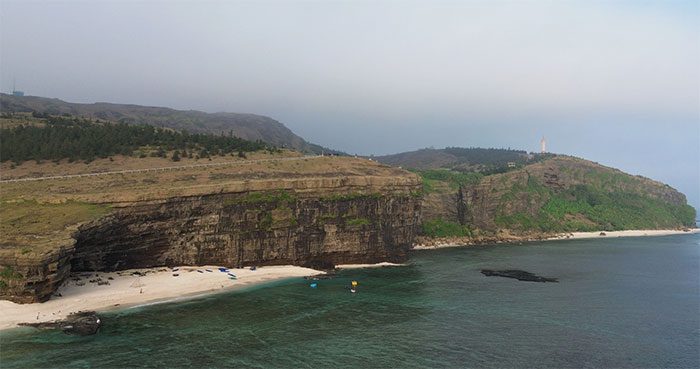
Thoi Loi Mountain is the largest volcano on Ly Son Island (Quang Ngai Province). Its peak rises over 169 meters, making it the highest point on Ly Son Island. This volcano has a base diameter of 1.4 km and a crater diameter of 0.35 km. The inner walls of Thoi Loi’s crater are steep, with a deep center that forms a lake. The eruption process of Thoi Loi Volcano has created spectacular landscapes, particularly the Cau Cave Cliff.
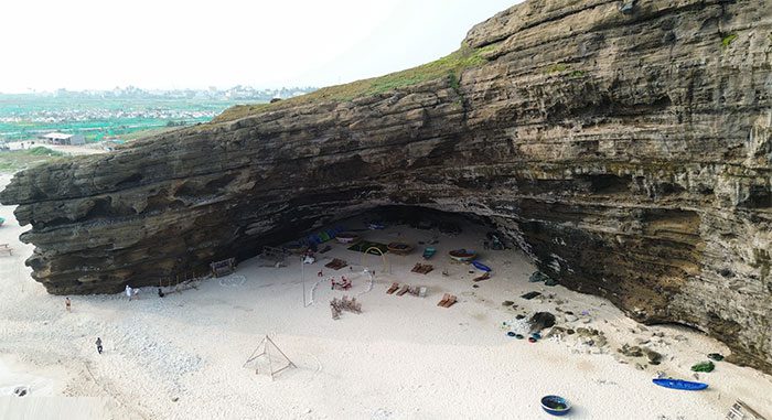
The cliff was formed by volcanic eruptions approximately 1 million years ago. Over time, the sea waves have eroded and hollowed out the foot of the mountain, creating a fairly large cave. Locals call this place Cau Cave.

The people of Ly Son believe that this place is named Cau Cave because the surrounding sea is abundant in seaweed, a type of algae with high nutritional value. (Photo: Bui Thanh Trung).
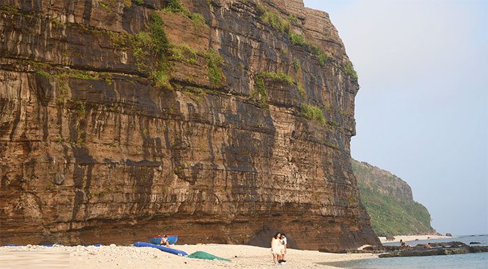
Geological changes over millions of years have created this magnificent cliff.
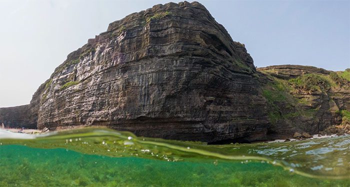
The nature at Cau Cave is pristine, with the sea on one side and the cliff on the other. Formed through multiple eruptions of the volcano, the Cau Cave cliff is likened to a “sandwich” with multiple layers of sediment stacked on top of each other. After millions of years of erosion, the sediment layers have gradually become visible (Photo: Bui Thanh Trung).
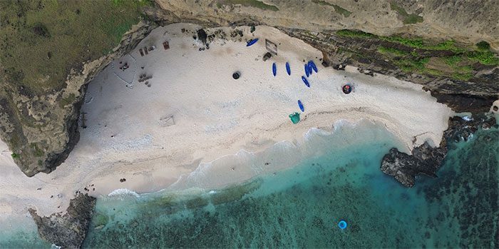
Cau Cave captivates visitors with rocky outcrops extending towards the sea. The waters at Cau Cave are an emerald green, complemented by fine sandy beaches.
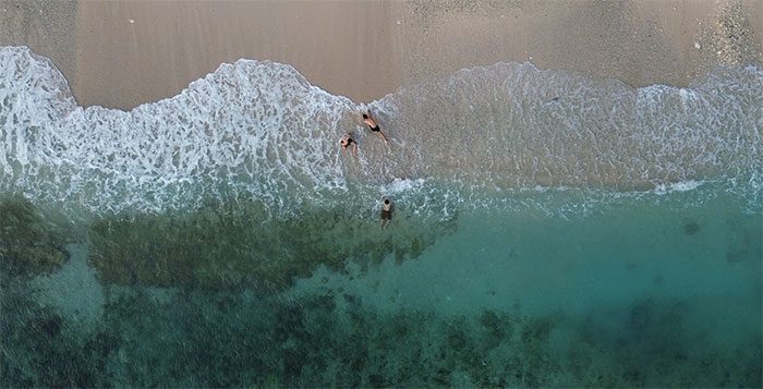
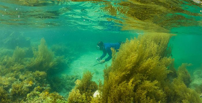
At Cau Cave, visitors can take photos beside the cliffs and splash around in the clear blue sea. Adventurous visitors can kayak, snorkel, and hunt for seafood.
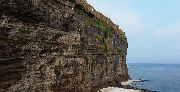
The cliff at Cau Cave is a nesting site for many seabird species.
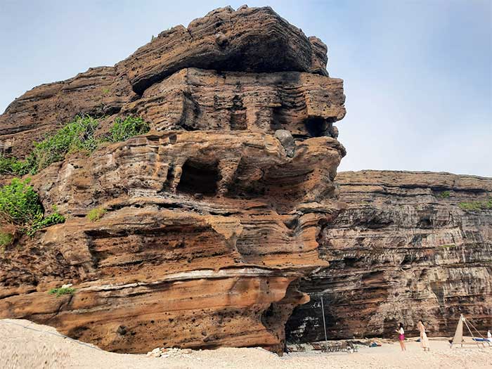
A portion of the cliff extends into the sea, shaped uniquely by wave erosion.
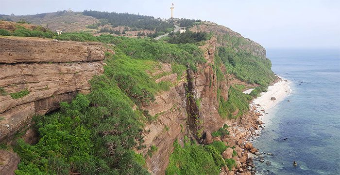
Above the cliff is the path leading to the crater of Thoi Loi Volcano and the national flagpole.


