At the end of yesterday afternoon (May 7), a widespread thunderstorm swept across Thanh Hoa and Nghe An, causing a sudden drop in temperatures, with hail and tornadoes reported in several areas. Just a few hours earlier, a record high temperature was recorded in Tuong Duong, Nghe An.
Breaking Historical Heat Records
The recent heatwave in Northern and Central Vietnam lasted for a short period but was particularly intense, with multiple temperature records being set.
On the afternoon of May 6, the Hoi Xuan measuring station in Thanh Hoa recorded a temperature of 44.1 degrees Celsius, the highest in Vietnam’s history, surpassing the previous record of 43.4 degrees set on April 20, 2019, in Huong Khe (Ha Tinh).
Shortly after, on May 7, the record in Thanh Hoa was broken. On the afternoon of May 7, the temperature recorded in Tuong Duong, Nghe An, was 44.2 degrees Celsius, becoming the highest temperature ever recorded in Vietnam, making Tuong Duong the holder of the historical heat record.

Central Vietnam recorded the highest historical heat yesterday afternoon. (Photo: Hoai Nam).
It is noteworthy that immediately following this record heatwave, a northeast monsoon moved in. This average-intensity northeast monsoon not only caused widespread thunderstorms across Northern and Central Vietnam but also led to a significant drop in temperatures, with the Northeast and Thanh Hoa experiencing cooler weather.
From temperatures above 40 degrees Celsius yesterday, today the areas of Thanh Hoa – Thua Thien Hue and the Northwest region are seeing highs of only 27-30 degrees Celsius, a drop of over 10 degrees compared to the previous day. In the Northeast, today’s maximum temperatures are only 24-27 degrees Celsius, with minimum temperatures ranging from 21-24 degrees, and some places dropping below 21 degrees.
Statistics from the National Center for Hydro-Meteorological Forecasting indicate that Northern and Central Vietnam is experiencing an unusual and severe summer, with heat arriving earlier and being significantly more intense than the historical average.
As early as March, a widespread and intense heatwave appeared in the Northwest and North Central regions, with 17 measuring stations recording record temperatures.
The average temperature in the Northern region, as well as the North and Central North Central regions in March, was generally 0.5-1 degrees higher than the historical average, with the Eastern North region exceeding by 1-1.5 degrees.
In April, meteorological authorities recorded 12 measuring stations across the country reaching the highest historical temperatures compared to previous years, primarily concentrated in Son La, Dien Bien, and Lai Chau. April temperatures in Northern and Central regions were also 1-1.5 degrees higher than the historical average.
It is important to note that directly following intense heatwaves are cold air outbreaks that cause widespread thunderstorms and a sudden drop in temperatures.

Today, widespread rain appeared in Northern and Central Vietnam, with temperatures dropping more than 10 degrees compared to yesterday.
According to weather expert Nguyen Ngoc Huy, under the influence of global warming, the movement of air masses becomes irregular and unpredictable. This leads to continuous weather changes, with conditions rapidly shifting from extreme heat to sudden coolness.
Dr. Huy also noted that the Indochina region, including Vietnam, is a convergence zone for many types of winds, including Northwest, Southwest, East, Northeast, and Southeast winds. These are monsoon trade winds. However, the chaotic temperature variations will cause these winds to blow out of season. This poses a danger when off-season trade winds converge, resulting in localized heavy rainfall.
A Severe Summer Ahead
Reports on global climate conditions from the World Meteorological Organization indicate that in recent years, indicators such as greenhouse gas concentrations, surface temperatures, ocean heat, ocean acidification, ice melting, and sea level rise have all reached record highs at the time of observation.
Climate change is causing increasingly severe weather and climate phenomena, extending heatwaves with higher intensity, greater rainfall, and more serious droughts.
According to the National Center for Hydro-Meteorological Forecasting, starting in June, sea surface temperatures in the central Pacific continue to trend upward and lean towards an El Nino phase.
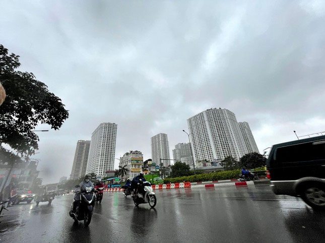
Experts warn of an unusual summer ahead.
Under the influence of El Nino, heat is likely to increase further from about May to July, particularly in the Northern and Central regions. It is predicted that the number of hot days will be more frequent and more intense compared to the same period in 2022.
In August 2023, heat will continue to occur mainly in the Northern and Central regions, with intensity likely to be more severe than during the same period in 2022. After that, the heat is expected to diminish somewhat around September 2023.
In the context of climate change, experts warn of the risk of extreme and intense heatwaves occurring in Northern and Central Vietnam this summer, with temperature records potentially being set.
