A high-speed tornado swept through the town of Rolling Fork, Mississippi, on March 24, as captured by satellite imagery, revealing widespread devastation and the harsh realities of climate change.
Rolling Fork is located about a 90-minute drive north of Jackson, the capital of Mississippi. Like many other areas, it is facing increasingly severe weather due to climate change.

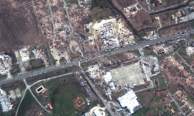
Satellite image of destroyed homes and businesses along Blues Highway in Rolling Fork, Mississippi, after the tornado struck on March 24. (Photo: Maxar Technologies)
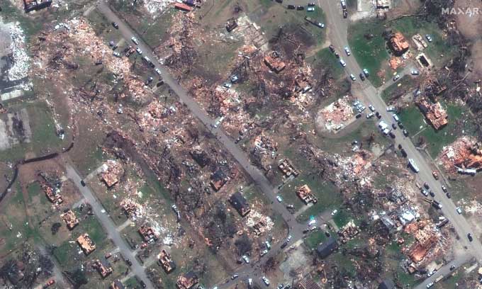
Maxar’s satellite from Maxar Technologies, a space technology company based in Westminster, Colorado, captured evidence of the tornado’s destruction on March 24 from Earth’s orbit. These images provide critical information for disaster recovery efforts. They show homes, buildings, and other infrastructure damaged by the tornado as it moved from the southwest to the northeast, passing through the center of Rolling Fork.
The tornado on March 24 was rated EF4 on the Enhanced Fujita scale, which ranges from EF0 to EF5, indicating increasing intensity. Tornadoes rated EF4 make up about 1% of all tornadoes, according to the National Weather Service. Meteorologist Bill Parker estimated that the maximum wind speed in Rolling Fork reached 274 km/h.
Rolling Fork has a population of 1,883, with a median household income of approximately $38,500 in 2020, according to U.S. Census data. About 20% of the population lives below the poverty line, with the majority of families being Black or African American. The toll of casualties and property damage is still being assessed.

Satellite image of destroyed homes along Mulberry and Walnut Streets in Rolling Fork, Mississippi, after the tornado struck on March 24. (Photo: Maxar Technologies)
The United States experiences more tornadoes than any other country in the world, averaging 1,150 tornadoes each year, which is more than the combined total of tornadoes in Canada, Australia, and all European countries. In the U.S., every state experiences at least one tornado annually, with some states facing dozens.
Tornadoes form when certain atmospheric conditions converge, including warm, moist air near the ground, cold air higher up in the atmosphere, and winds that overlap while moving at different speeds and directions. Few places in the world meet these conditions, and none can compare to the Great Plains of North America, located west of the Mississippi River and east of the Rocky Mountains.


