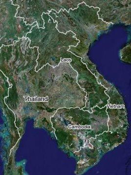
A unique website has appeared on the global information network, allowing people for the first time to view images, from a global scale down to their own homes, through satellite photos.
The image quality of this free satellite photo service is very high.
Currently, the homepage of wikimapia.org allows us to see satellite images of the 100 largest cities in the world, including two cities in Vietnam: Hanoi and Ho Chi Minh City.
 |
| Images of Vietnam, digital satellite photos, via Google Maps |
With just a keyboard, a mouse, and a moderately configured computer connected to the internet, an ordinary person can now view Hanoi from a panoramic view down to the details of each house—something that just a few years ago would have been considered top secret.
What’s intriguing is the high level of interactivity of this unique software. Viewers can also participate in identifying landmarks, editing addresses, moving around, and filling in historical information about a structure or a street.
Viewing images of Hanoi closely reveals many landmarks that are surely familiar to Vietnamese people. From street names and locations of government offices (such as Hoang Quoc Viet Street, Vietnam Academy of Science and Technology, Information Technology Institute) to the names of buildings and homes. There are places marked as “House of Nguyen Huu Chi”, “House of Truong Linh”, “House of Dieu Linh – Dieu Huong”.
Some places indicate “63 Nha Chung, the small alley where my house is located”. Others write “Linh Lang Street! Why can’t it be spelled in Vietnamese?” and there’s even a “toilet pub” (public restroom) right next to the foot of Chuong Duong Bridge.
A Double-Edged Sword
Professor and Doctor Tran Manh Tuan – Director of the Space Technology Application Coordination Center (Vietnam Academy of Science and Technology) – mentioned at a recent workshop on space science for students in Hanoi that remote sensing images like those on Wikimapia serve as a wonderful visual educational tool for the public and the youth to better understand the value and significance of the space industry.
To some extent, it also greatly assists planners and builders, in addition to expanding the public’s geographical and national knowledge.
In the future, satellite maps will continue to be updated by Digital Globe (USA) with more landmarks, enhanced features, and higher quality.
However, scientists warn that regardless of the quality, these are merely reference images and hold no legal value.
Google Maps itself also clarifies that it does not take responsibility for the accuracy of the information on the maps or images. To obtain images with commercial and legal value, service providers specify the need to visit other websites and use different services such as Google Maps API, for example.
One of the pieces of evidence for the low reliability of these images is that anyone can participate in editing and correcting information as mentioned above. The downside of this feature is the risk of turning the global digital map into a repository of countless pieces of junk information alongside useful data.
To harness the positive aspects of technology, if individuals are left to exploit it independently, effectiveness may be difficult to achieve.


