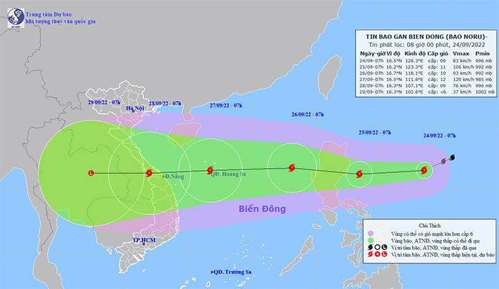
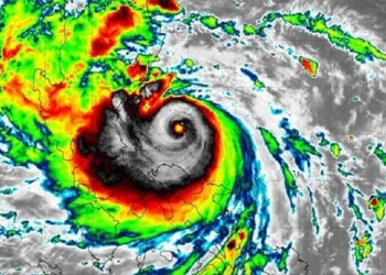
Tropical Storm Noru is forecasted to move very quickly, reaching speeds of up to 30 km/h, potentially intensifying to levels 11-12, with gusts up to level 15, heading towards the central provinces of our country.
As of 7 AM today (September 24), the center of Tropical Storm Noru was located approximately 710 km east of Luzon (Philippines). The maximum wind speed near the center of the storm was level 9 (75-88 km/h), with gusts reaching level 11.
Forecast for the next 24 hours indicates that the storm will primarily move west-southwest at about 20 km/h and will gradually intensify. By 7 AM on September 25, the center of the storm is expected to be about 130 km east of Luzon. The maximum wind speed near the center will reach levels 10-11 (89-117 km/h), with gusts up to level 14.
In the following 24 to 48 hours, the storm will shift to a west-northwest direction, traveling at speeds of 20-25 km/h as it enters the East Sea, becoming the fourth storm of this year’s rainy season. By 7 AM on September 26, the center of the storm will be over the eastern waters of the North East Sea, approximately 650 km east of the Paracel Islands. The maximum wind speed near the center will be level 9-10 (75-102 km/h), with gusts reaching level 13.
In the next 48 to 72 hours, the storm will move quickly to the west at about 30 km/h and is expected to strengthen. By 7 AM on September 27, the center of the storm will be over the Paracel Islands. The maximum wind speed near the center will reach levels 11-12 (103-133 km/h), with gusts up to level 15.

Tropical Storm Noru is forecasted to move rapidly after entering the East Sea.
Due to the storm’s impact, starting around the afternoon of September 25, the eastern waters of the North and Central East Sea will experience strengthening winds of level 6-7, with near-center winds reaching levels 8-9, gusting up to level 11, and wave heights of 4-6 meters, resulting in rough seas.
In the next 72 to 120 hours, the storm will continue to move quickly mainly towards the west at speeds of 20-25 km/h, with a gradual weakening in intensity, potentially affecting the Central region.
The National Center for Hydro-Meteorological Forecasting has indicated that the East Sea is beginning to enter the peak of this year’s rainy season. It is forecasted that from now until March 2023, there will be approximately 5-7 storms and tropical depressions in the East Sea, with 2-4 of them potentially impacting the mainland directly. There is a possibility that tropical cyclones may still occur in January 2023 in the southern East Sea region.
The meteorological agency also advises that during years influenced by La Niña, such as this year, caution should be exercised regarding strong storms with complex and unusual movement patterns.
Due to the frequent storms towards the end of the year, combined with the potential early arrival and strong activity of cold air, the Central region faces the risk of heavy and continuous rainfall in the last months of the year, leading to risks of flash floods and landslides.
Forecasts for October indicate that the total rainfall across most regions of the country will be significantly above the long-term average, with the North potentially exceeding by 20-40%, the South by 10-20%, and the Central region by 20-50%. Notably, the Central Highlands may experience average rainfall in October this year that is 40-80% higher than the long-term average, raising concerns about flooding, flash floods, and landslides.
Tropical Storm Noru formed from a low-pressure area offshore the Philippines, strengthening into a tropical depression on September 22, and further developing into a storm by September 23, is considered a relatively strong storm with the potential for direct impact on our mainland.


