Our world is incredibly vast and filled with beautiful natural wonders. Join us as we explore the top 10 most extraordinary geological sites below.
Places with Quirky Geology on Earth
1. The Three Sisters
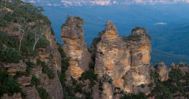
In the Blue Mountains of Australia near Katoomba, a tourist town that houses the local residents, the Three Sisters is a trio of sandstone spires formed by erosion.
With names like Meehni, Wimlah, and Gunnedoo, they found their place in the ancient mythology of the Indigenous peoples in the area. The legend of the three sisters states that these women fell in love with three men from a neighboring tribe.
After the three men, who were brothers, eloped with their flames, a war broke out, and the three women were turned to stone by a wizard to protect them from harm. The wizard died in the ensuing battle, and no one lived to restore them. Therefore, they remain as stone pillars, eroded day by day.
2. Fairy Chimneys
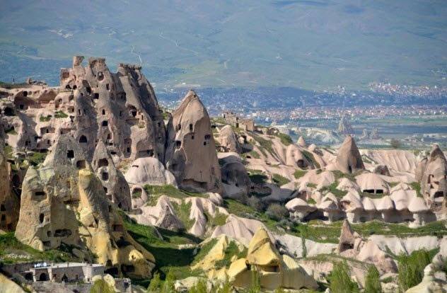
The Fairy Chimneys of Cappadocia, Turkey, are a testament to both volcanic power and human ingenuity. These marvelous conical rocks formed millions of years ago when volcanic eruptions blanketed a vast area of present-day Turkey with ash, solidifying into a soft rock known as “tuff.”
Subsequently, the tuff was capped with a harder layer of basalt. As erosion affected various ages and epochs, the soft tuff was worn away while the remaining basalt created numerous deep hollow structures filled with caves. When humans arrived in Cappadocia, they discovered a rugged landscape that was ready to be carved into stone houses, which they did.
Throughout recorded history, this area has been inhabited. Its vast network of caves has provided shelter for residents for thousands of years amidst many wars between Persians, Greeks, Turks, and others. The caves are thought to have served as hiding places for persecuted Christians when their faith was outlawed during the years of the Roman Empire.
3. Mount Roraima
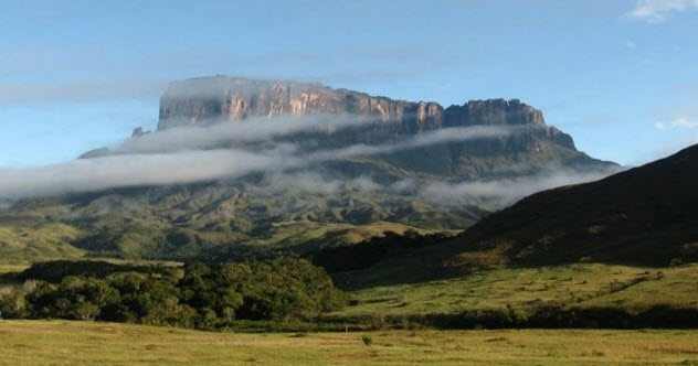
Located in the heart of the Pakaraima Mountains in Venezuela, Mount Roraima resembles a gigantic table more than a typical mountain.
Roraima sits atop the Guiana Shield, a Precambrian system that contains some of the oldest rocks on Earth, over two billion years old. Although Europeans did not discover it until 1595 during an expedition led by the Englishman Walter Raleigh, one of the daring explorers searching for the legendary El Dorado, the massive plateau has held spiritual significance for the Pemon and Kapon peoples. They viewed Mount Roraima as a majestic tree that bore all the fruits and vegetables the world had to offer.
According to legend, the trees were knocked down by Makunaima, a wicked trickster who caused floods in the surrounding lands. Today, Mount Roraima bears no fruit, but its unique geology and sheer cliffs are a tremendous draw for scientists and climbers seeking geological thrill. The mountain is also shrouded in almost perpetual rain clouds, allowing Makunaima’s legacy to persist.
4. Shilin Forest
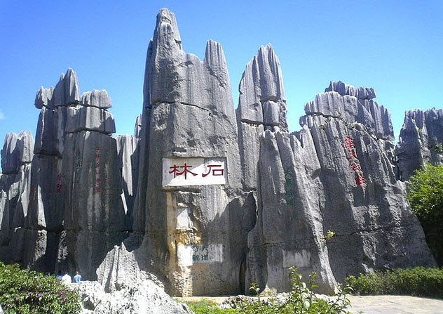
Deep within the heart of Yunnan Province in southern China lies a formation that might be mistaken for distant fossilized trees. Known as “Shilin Forest” or “Stone Forest,” this collection of limestone pillars spans 500 square kilometers and was formed by limestone erosion, estimated to be nearly 300 million years old. It is part of a larger area known as the South China Karst, renowned for its natural beauty and biodiversity.
Although it was only recognized as magnificent upon achieving UNESCO World Heritage status, Shilin has captured the hearts and minds of locals for millennia, spawning its own legends. The most prominent legend in the forest is the story of Ashima, a beautiful young girl who turned to stone as punishment for falling in forbidden love.
5. Tsingy de Bemaraha
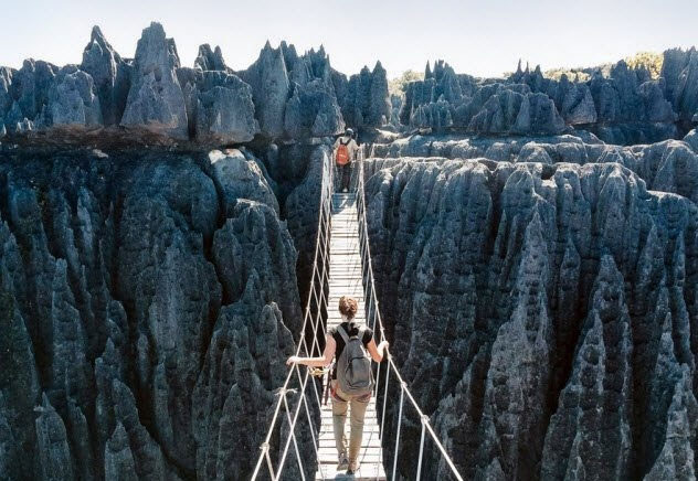
Located in the northwest of Madagascar, the fourth largest island in the world off the coast of Africa, Tsingy de Bemaraha is a massive limestone formation with dazzling limestone piles that outshine Shilin.
The Tsingy islands, which are limestone plateaus, have been eroded and worn away by underground water systems for millions of years. Known as the “Badlands of Madagascar”, the name translates to Malagasy as “a place where no one can walk barefoot.” It is imagined that a forest of small and large stone trees would be impossible to traverse without hiking boots.
Nonetheless, Tsingy de Bemaraha National Park is home to a plethora of endemic species, from lemurs to mangrove forests to birds that seem to exist only in paradise.
6. Sơn Đoòng Cave
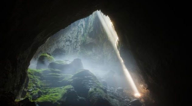
When thinking about weather systems and climates, caves are not typically considered. However, in northern Vietnam, there exists a massive cave that creates its own natural climate. Discovered by a conservationist named Hồ Khánh in 1991, Sơn Đoòng Cave is the largest known cave on Earth. It is astonishing that it has its own climate.
Clouds form and rain falls frequently within this cave, creating the necessary humidity for the forests and rivers that lie above. Stretching approximately 9,000 meters (30,000 ft) in length and with a maximum depth of 150 meters (490 ft), the grandeur of Sơn Đoòng can easily be compared to many towering skyscrapers.
Due to the difficulty of accessing the caves and the associated dangers, human entry for climbing and exploration is severely restricted each year. Plans are currently underway to construct a cable car to enhance accessibility to the gems of this geological region.
7. Driftless Area
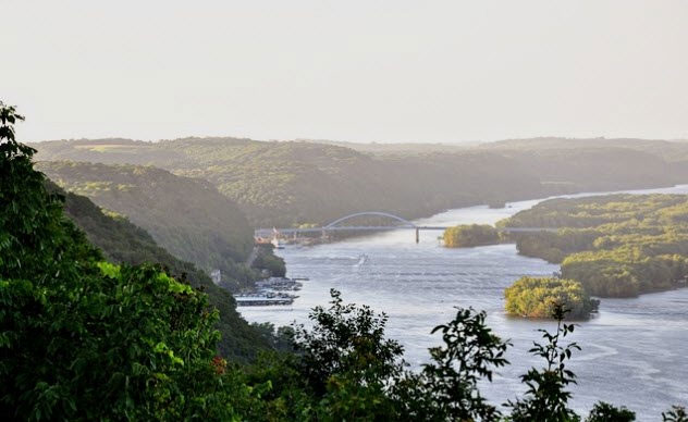
The Driftless Area, also known as the Paleozoic Plateau, spans over 42,000 km2 (16,200 mi2) in the Midwest of the United States. It includes parts of Illinois, Iowa, Minnesota, and Wisconsin. Known for its stunning landscapes along the Mississippi River and deep valleys, this area is considered one of the most geologically unusual regions in the United States.
As glaciers from the last Ice Age moved southward, humans sought everything around the area. Most overlooked the rocky ridges due to the elevation of the Wisconsin Plateau, which led to vast glaciers to the east and west of them. This area is filled with remnants from the Ice Age, such as Pleistocene snails. Another fascinating feature of this land is the slate cliffs, a formation of porous rock filled with cold ice.
At the foot of the slopes lies a network of caves, many of which are also filled with ice. From its landscapes, wildlife, and geology, the Driftless Area is truly an uncut diamond that has not been extensively explored by humans.
8. Mount Thor
Named after the Norse god of thunder, Mount Thor is known for its sheer vertical rock face, making it one of the hardest mountains to climb in the world.
Mount Thor is located in Auyuittuq National Park, on the remote Baffin Island in northern Canada, but it is not the highest peak in the park. Nevertheless, Mount Thor, with its many vertical cliffs, poses the most daunting challenge, especially when viewed from the west.
Mount Thor stands like a statue in the snowy wilderness of Auyuittuq National Park in Canada.
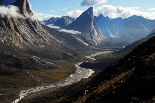
While there are many mountains taller than the spire of Mount Thor, there is one measure in which this Arctic land outshines them all: the highest vertical drop in the world.
Located in the Baffin Mountains on Baffin Island, Canada, this granite limestone massif has a vertical drop of 1,250 meters, which is an astounding 1.5 times the height of the Burj Khalifa – the tallest building in the world!
Mount Thor is regarded by many as one of the hardest rocks to climb, not only because of its steepness but also due to its composition of granite, a hard and slippery material that lacks footholds and grooves. Despite the mountain’s remote location, many intriguing features make it a popular rock climbing destination, attracting adventurers and climbers alike.
Mount Thor retains its pristine nature from the fierce Ice Age that swept across the Arctic. Today, Mount Thor is a favorite spot for hunters and paragliders.
9. Dry Valleys of McMurdo
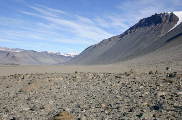
Unless you plan to become a scientist, you will likely never find yourself near the Dry Valleys of McMurdo. This formation consists of volcanic ash and granite in Victoria Land, Antarctica, west of McMurdo Sound. While most of the continent in the southern polar region is covered by at least 1.6 km (1 mile) of ice, the Dry Valleys of McMurdo have remained arid. It is estimated that they have not seen rain for millions of years, making them the driest desert in the world! Two factors contribute to the extreme dryness of this basin. First, the surrounding mountains are high enough to block coastal rainfall and push back glaciers.
Additionally, powerful katabatic winds, which sweep across the Antarctic coast at speeds of 320 km/h (200 mph), heat the air and strip moisture as they move inland. The end result is a barren environment. It is said jokingly that we might expect to find Matt Damon listening to classic disco music, waiting to be rescued in a place with no escape.
10. Siberian Traps
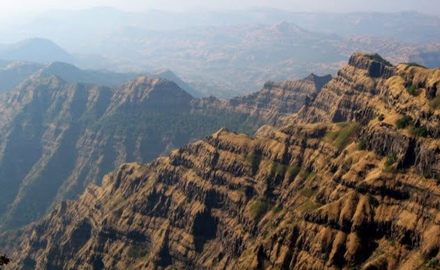
Of all the entries on this list, the Siberian Traps have the darkest history. This vast expanse of flooded basalt layers cooled and solidified, covering nearly 2.6 million km2 in northern Asiatic Russia. Their formation is attributed to one of the largest volcanic eruptions in the region, occurring approximately 4.6 billion years ago, coinciding with a significant mass extinction event.
The eruption and its impact on the environment and atmosphere are linked to the Permian-Triassic extinction event (also known as the Great Dying), in which over 90 percent of all life on Earth came to an end. To gaze upon the towering columns of the Siberian Traps is to witness the greatest “killers” of all time. Today, the traps are renowned for their mineral wealth, including deposits of copper, nickel, and palladium. These reserves are the raw materials for Norilsk Nickel, the largest producer of nickel and palladium in the world.


