New satellite images released by NASA’s Earth Observatory show Indonesia’s new capital emerging from the jungles of Borneo.
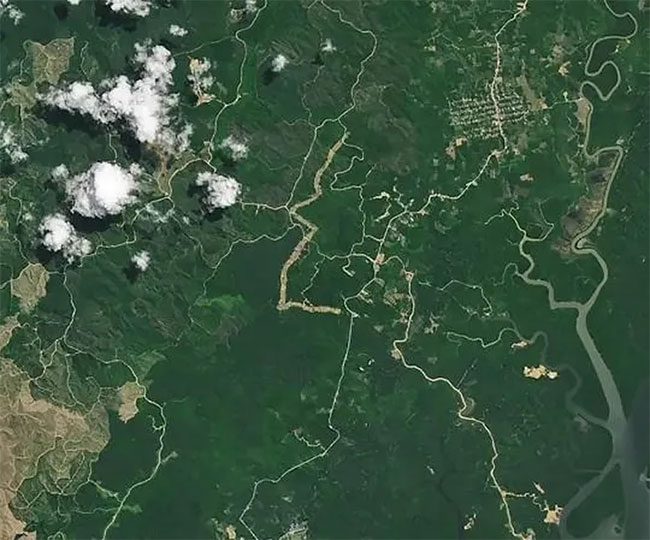
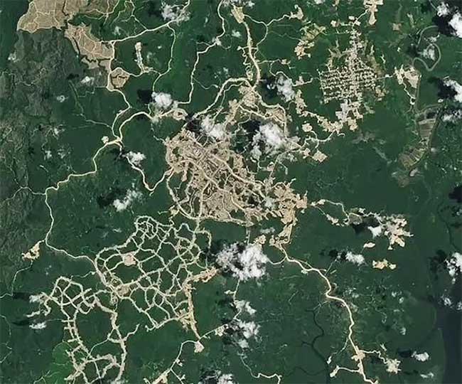
The latest satellite images, taken in February, reveal significant changes just two years after roads have begun to form on the previously lush green canopy. Gradually, buildings are rising in areas that were once covered by dense greenery.


Nusantara capital is taking shape. (Photo: PetaPixel).
Preserving Green Spaces
However, greenery will not be completely absent in the new city of Nusantara, located on the eastern coast of Borneo, as the new capital of the archipelago is expected to be completed by 2045.
Planned to span over 2,500 km2, the city will feature a vast urban area interspersed with waterways and lush green spaces, with up to 75% of the area conserved for nature.
Nusantara will replace Jakarta, Indonesia’s current capital, a sprawling metropolis with a rapidly growing population of 30 million located nearly 1,000 km away.
This move is not only symbolic but also aims to decentralize a government historically criticized for overly focusing its policies on Java Island, where the capital is located and where over half of Indonesia’s population resides.
In addition to chronic traffic congestion and toxic air, Jakarta is also sinking.
The land where Indonesia’s capital is located is subsiding, and sea levels are rising.
With heavy rainfall and frequent flooding, a quarter of the city could be underwater by 2050.
The NASA Earth Observatory stated: “Jakarta must contend with frequent flooding, congested traffic, dangerous air pollution, and a lack of drinking water.”
“Jakarta is also sinking rapidly. Excessive groundwater extraction has contributed to a subsidence rate of up to 15 cm per year, with 40% of the city now below sea level.”
Good Construction Progress
Finding new housing for city residents and government agencies has become an urgent issue since Indonesian President Joko Widodo announced in 2019 that the nation’s administrative center would move from Java to the sparsely populated island of Borneo.
Recent satellite images indicate that Indonesia is making solid progress in its capital relocation plan, despite concerns that the government is only committing to cover 20% of the project’s costs.
The remaining 80% is expected to be raised from international investors.

East Kalimantan Province on Borneo – the site of the new capital Nusantara. (Photo: Nikkei Asia).
Images captured by OLI-2 (Operational Land Imager-2) on Landsat 9 and OLI on Landsat 8 show significant transformations in Nusantara in April 2022 and February of this year.
Construction of Nusantara – an ancient Javanese term meaning “outlying islands” or “archipelago” – began only in July 2022.
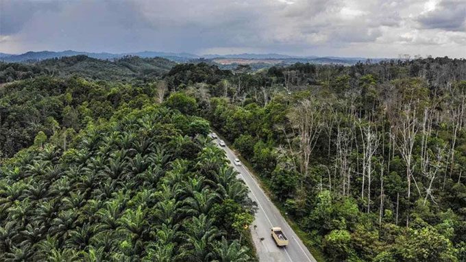
The network of roads through the forest has exposed the land in areas that previously included forests and oil palm plantations, located 45 km from the Makassar Strait.
Buildings can also be seen being constructed near Balikpapan Bay in East Kalimantan in the latest satellite images.
According to the project’s website, government facilities and about half a million people are expected to be accommodated in the project’s initial phase.
The NASA Earth Observatory stated: “Project plans indicate that this will be a ‘green, walkable’ city powered by renewable energy, with 75% of the city area as forest.”
“However, some researchers are concerned that this change in land use could harm the forests and wildlife in the area.”
“The coastal land and waters being developed are highly biodiverse and home to mangroves, proboscis monkeys, and Irrawaddy dolphins.”


