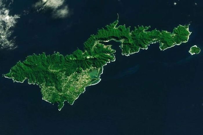
The US territory of the Samoa Islands may serve as a clear example of the Earth’s plate tectonics process, which, according to theory, has caused continents to repeatedly merge and then separate.
Using InSAR technology, NASA scientists have revealed that the subsidence rate of this volcanic island chain is sharply increasing, particularly after a powerful 8.1 magnitude earthquake occurred nearby, leading to the disastrous tsunami in 2009.
The islands are sinking, not only due to rising sea levels; the reality is that they are being gradually swallowed by the Earth. Earthquakes do not cause this; they merely fuel the main culprit: the plate tectonics process.

Samoa is being “swallowed” by the Earth through plate tectonics – (Photo: NASA).
As many previous studies have indicated, the Earth’s crust is not seamless; it is divided into about 20 large and small pieces known as “tectonic plates.”
These plates bear the continents and oceans, continuously moving, resulting in the continents frequently forming supercontinents and then separating. Currently, the planet may be shifting to merge the continents into a hypothetical supercontinent called Amasia.
The time scale for each movement is very lengthy, taking at least hundreds of millions of years for a single “transformation,” which is far too long for humans to measure directly. Therefore, plate tectonics is still regarded as a theory built on various indirect pieces of evidence.
However, Samoa may represent a rare direct piece of evidence of a process known as “subduction” in the oceans, which causes oceanic areas to shrink and pulls surrounding continents closer together, according to SciTech Daily.
Samoa is located in the western Pacific region, where the boundaries of the Pacific and Australian tectonic plates meet. These two plates are sliding against each other, creating a subduction zone along the famous Tonga Trench, accompanied by frequent earthquakes. Scientists have measured the Earth’s vertical movement after each earthquake, including the movement of materials deep beneath the Earth’s surface, reflected through seismic waves.
“Over hundreds of thousands, even millions of years, volcanic islands tend to sink as they cool down. This long geological process applies to the Samoa Islands, and the earthquake cycle exacerbates this,” explained geophysicist Eric Fieling from NASA’s Jet Propulsion Laboratory (JPL-NASA).
A more pronounced manifestation of subduction appears to be that a vast area around Samoa seems to be pulled down, causing sea levels relative to the land to rise five times faster than the global average, with increasing acceleration following earthquakes.
The discoveries in Samoa are a basis for NASA scientists to move towards a detailed model of the impact of plate tectonics across the globe, helping to refine models predicting sea level rise. Clearly, this complex geological process causes different areas to sink in various ways.
This project, named NISAR, is scheduled to launch in 2024, co-developed by NASA and the Indian Space Research Organisation (ISRO).
“We need to understand how quickly that land is sinking to make policy decisions based on scientific data,” said geophysicist Jeanne Sauber from NASA’s Space Flight Center regarding plans for coastal recovery and resettlement, which may become very pressing in the future.


