A British aerospace engineer has claimed to have pinpointed the exact coordinates of the ill-fated MH370 aircraft, which crashed into the Indian Ocean, raising hopes of unraveling one of aviation’s greatest mysteries.
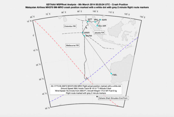
According to 9news.com.au, using aviation tracking technology, British aerospace engineer Richard Godfrey announced that he has identified the location where MH370 fell into the sea, specifically approximately 1,933 km west of Perth, Australia, at coordinates “33.177°S (south) 95.300°E (east)”.
The aircraft is believed to be resting at a depth of 4,000 meters on the ocean floor.

The wreckage of MH370 is located 1,933 km west of Perth, Australia – (Photo: mh370search.com).
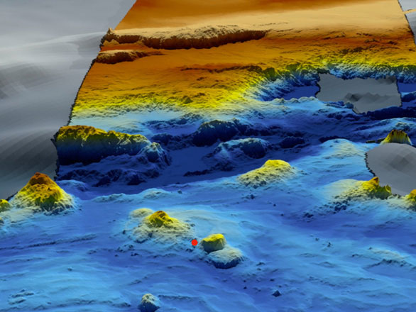
“The crash site is located at the foot of Broken Ridge (an oceanic plateau in the southeastern Indian Ocean), in a region characterized by rugged terrain, featuring peaks, cliffs, an underwater volcano, and a canyon,” Mr. Godfrey stated in a report published on mh370search.com on November 30.
Mr. Godfrey predicts that his research will lead to the discovery of MH370 in 2022.
His study is based on software that detects and tracks every aircraft anywhere in the world (GDTAAA) and data from the Weak Signal Propagation Reporter (WSPR) system.

According to Richard Godfrey, the aircraft crashed in a rugged underwater area – (Photo: mh370search.com)
In 2018, Ocean Infinity (USA) conducted a search over an area of 112,000 km2 for three months but did not find MH370. The new location mentioned in Mr. Godfrey’s report is approximately 28 km from where Ocean Infinity previously searched.
Malaysia Airlines Flight 370 (MH370) disappeared on March 8, 2014, while en route from Kuala Lumpur (Malaysia) to Beijing (China), with 239 people on board.
In 2016, Australia, Malaysia, and China agreed that an official search would only resume if the three countries had reliable evidence pinpointing the aircraft’s specific location.


