The submerged remnants of an ancient Roman road have been discovered at the bottom of the Venice lagoon, along with archaeological structures believed to be remnants of a dock and settlements.
This discovery provides evidence that much of the city of Venice was once dry land. The remains are thought to date back centuries before Venice was established in the early medieval period.
New findings at the Treporti Canal, located in the northern part of the outer lagoon of Venice, confirm the results of an archaeological survey conducted in the area during the 1980s, suggesting that the currently flooded region was primarily dry land, according to Fantina Madricardo, a geophysicist.
The Institute of Marine Science (ISMAR) in Venice is the lead author of a new study published on July 22 in the journal Scientific Reports. The area may have had several small permanent settlements and roads connecting them to nearby trading centers.

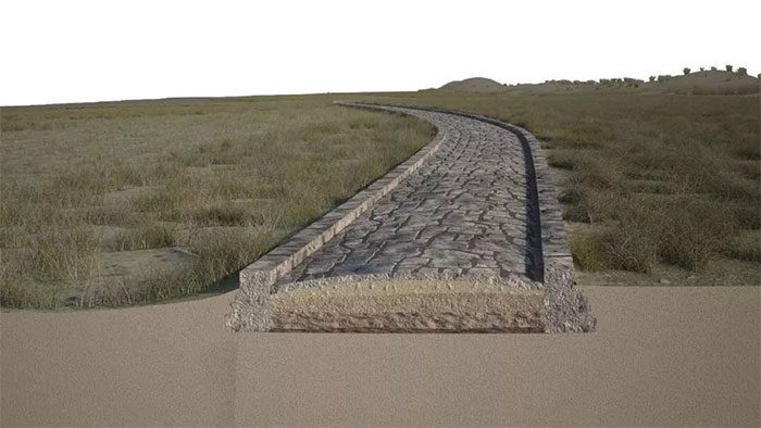
Reconstruction of the road in the ancient Roman belt.
Madricardo stated: “The Venice lagoon formed due to rising sea levels after the last ice age, making it a long process. We know that from the Roman era—about 2,000 years ago—the sea level there rose by two and a half meters.”
The change in sea level means that vast areas of the lagoon currently underwater were once dry land, and archaeological evidence indicates that this land was crossed by at least one well-constructed road.
The research team identified a section of the submerged Roman road extending over 1,000 meters, along with a structure in the northeast that may have once served as a docking area for boats.
Venice has a history spanning centuries, but there are no records of the city in Roman literature. Archaeologists believe it began as a collection of villages on islands in the area after the Western Roman Empire collapsed in the late fourth century.
Roman artifacts have previously been found in waterways and on islands in Venice, but the extent of human occupation there during the Roman period remains unclear; some scientists suggest the area was densely populated, while others argue it had little settlement at that time.
In the latest study, Madricardo and her team used sonar scanning and conducted archaeological dives in the Treporti Canal in 2020, where they discovered 12 archaeological structures aligned in a northeast direction over a distance of 1,140 meters.
The submerged structures rise up to 2.7 meters and extend up to 52 meters, potentially representing the remnants of an ancient road built above the surrounding countryside, she noted.
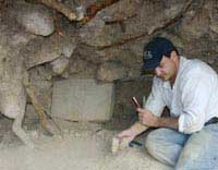
Archaeological dives also uncovered stones with flat tops and egg-shaped bottoms, similar to the basalt used by the Romans—a type of stone traditionally used for paving the upper surfaces of ancient Roman roads.
The research team also found a group of submerged structures hidden beneath the road, at a depth of about 9 meters. Researchers indicated that these structures could be the remnants of an ancient dock located in a water channel next to the road, and that the dock was larger than a basketball court.
So far, scientists have not been able to determine exactly when the Roman road was constructed and how long it was used before this strip of land was eventually covered by sea waves.
Although the area has been completely altered over the past 200 years, Madricardo hopes that sediment cores from the lagoon’s bottom may yield radiocarbon dating, which could reveal more about its age.


