Test flights of unmanned aerial vehicles (UAVs) are currently underway in Antarctica, assisting scientists in researching methods to collect data on the icy continent.
The Windracers ULTRA UAV has flown over 700 kilometers to gather data that may help scientists better understand how Antarctica is being affected by environmental changes.

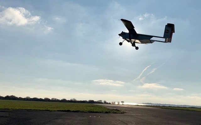
The Windracers ULTRA UAV is fully automated. (Image credit: Windracers)
Dr. Tom Jordan, an airborne geophysicist at the British Antarctic Survey, stated that utilizing aerial data collection methods is an effective approach, as the UAV can observe the environmental and ecological landscape over a large area without the need for humans to step onto the thick ice.
“Previously, we used smaller UAVs, and typically each type of UAV was dedicated to a single research project. Now, with a larger design featuring a payload compartment, we can place various scientific sensors here. We have activated environmental sensor camera systems that can capture images and hyperspectral imagery to study the ecosystems of certain islands and bays,” Dr. Tom Jordan shared.
According to Dr. Jordan, gravity and magnetic sensors are also utilized to examine the geology of the rocks beneath the water and ice. This is crucial for helping scientists understand how ice may melt in the future. Ultimately, the newly tested radar system will allow them to see through the ice to study the shapes of the landscapes buried beneath the 4,000-meter-thick ice.
Designed specifically for extreme environments like Antarctica, the Windracers ULTRA UAV is a fully automated aircraft with two engines, a wingspan of 10 meters, capable of carrying 100 kilograms of cargo or sensors, with a flight range of 1,000 kilometers. This UAV can continue flying even if one of its engines or components fails and is designed to land on-site with minimal parts required.


