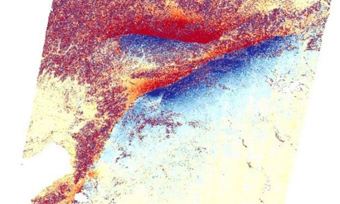
The powerful earthquake in Turkey on February 6 caused the Earth’s crust to develop two gigantic cracks measuring up to 300 km near the Turkey-Syria border.

Two cracks appeared after the earthquake in Turkey captured by the Sentinel-1 satellite. (Photo: COMET).
Researchers from the Center for Observation and Modeling of Earthquakes, Volcanoes, and Tectonics (COMET) discovered the cracks by comparing images taken of the area near the Mediterranean coast using the Sentinel-1 Earth observation satellite before and after the earthquake disaster. The longer crack stretches 300 km northeast from the Mediterranean Sea. This crack was created by a powerful earthquake measuring 7.8 on the Richter scale, which occurred at 4:17 AM local time on February 6 (8:17 AM on February 6 in Hanoi). The second crack, measuring 125 km, opened up after a 7.5 magnitude earthquake that occurred about 9 hours later, according to a statement by COMET on Twitter on February 10.
According to Professor Tim Wright, the lead researcher at COMET, such cracks typically appear after strong earthquakes. However, these two cracks are unusually long. They are evidence of the immense energy released by the earthquake. “The larger the earthquake, the larger the fault and the more it slips. This earthquake fault is one of the longest in continental history. It is unusual for two major earthquakes to occur just hours apart,” Wright commented.
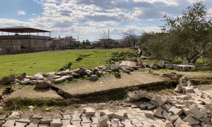
The tectonic movement that caused the earthquake was so strong that the cracks are clearly visible on the ground, running through several towns and slicing through some buildings. Many local scientists also shared images of the cracks on the ground, confirming what the satellites observed from space.

The crack runs through the town of Hassa. (Photo: Ozdemir Alpay)
The northern region of Cyprus frequently experiences strong earthquakes due to the convergence of the Anatolian, Arabian, and African tectonic plates, creating pressure when they collide. However, experts note that the recent earthquake is particularly noteworthy due to its intensity and the scale of destruction. Nearly 24,000 people have died, and many victims remain buried under the rubble as rescue efforts progress slowly, especially in Syria, a country ravaged by armed conflict for many years. In Turkish cities such as Türkoğlu, Kahramanmaraş, and Nurdaği, thousands of buildings have collapsed, leaving countless people homeless.
After the earthquake, satellites operated by government agencies and private companies are assessing the damage. According to NASA, the earthquake occurred along a fault line at a depth of 18 km below the surface. The shallow epicenter means that the vibrations spread with intense force, reaching hundreds of kilometers from the epicenter. According to Eric Fielding, a geoscientist at NASA’s Jet Propulsion Laboratory, the length of the crack and the intensity of this earthquake are similar to the 1906 earthquake that devastated San Francisco.


