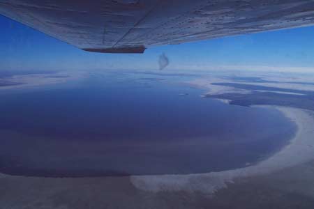
Lake Eyre, located in central Australia, is a very peculiar lake that alternates between being present and absent. In 1832, an exploration team visited and discovered a small basin covered with a layer of salt. By 1860, another expedition found a vast expanse of saline water. However, when they returned the following year to measure the lake’s surface area, it had vanished, leaving only a small basin where the waves once lapped.
In reality, this is not a lake that is always filled with water; it is a seasonal lake. It disappears approximately every three years.

Image of Lake Eyre dry, with only a layer of salt on the lakebed (Photo: heidbus)
So, where does the lake’s water go? The water in Lake Eyre primarily comes from rainfall and river sources. When there is substantial rainfall, the lake’s area can reach up to 8,200 km2; during dry spells, the water evaporates significantly, causing it to dry up to the bottom. Therefore, the lake’s area according to geographical definitions is 0-8,200 km2, with no fixed figure.
To improve the arid climate conditions in central Australia, scientists have focused on this lake. They proposed digging a canal to connect Lake Eyre with the sea. The lake is situated 12 meters below sea level, which would allow seawater to flow into the lake naturally, eliminating its episodic presence.

Aerial view of Lake Eyre with considerable water still present (Photo: tabbagong)


