China is enhancing the use of satellite and radar technology in disaster relief efforts as extreme weather events become increasingly frequent.
The country is currently facing one of the most severe flooding events in its history, following the devastating Typhoon Gaemi that struck at the end of July.
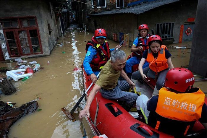
Satellite imagery can be used to coordinate disaster relief efforts (Photo: CNS/AFP).
According to Xinhua News Agency, 87 rivers in 7 provinces (including Heilongjiang, Jilin, Liaoning, Zhejiang, Fujian, Jiangxi, Guangdong) and the Inner Mongolia Autonomous Region in northern China have experienced rising water levels.
Heavy rainfall in Hunan Province, central China, has also caused three dam breaches within less than 20 hours, forcing thousands of residents to evacuate as floodwaters exceeded record levels.
In response to this severe natural disaster, China has implemented advanced technologies such as satellites and radar in its disaster relief efforts.
Professor Weng Qihao from the Department of Land Surveying and Geo-Informatics at the Hong Kong Polytechnic University noted that this approach was a lesson learned from the catastrophic earthquake in Sichuan in 2008.

Rescue teams address the dam breach incident at Dongting Lake in Hunan Province (Photo: Xinhua News Agency).
At that time, rescue operations were hampered by limited satellite coverage and poor-quality imagery.
This resulted in rescue teams being unable to determine where the disaster had occurred and which routes were accessible. At least 69,000 people lost their lives, and over 370,000 were injured in this disaster.
Lessons from the Historic Earthquake
According to Professor Weng, since that earthquake, the Chinese government has intensified the use of orbital satellites tasked with monitoring natural disasters and supporting relief and reconstruction efforts. It is estimated that China has over 900 satellites in orbit used for this purpose.
Most recently, when the dam breach occurred at Dongting Lake in Hunan Province after heavy rain, satellites were utilized to monitor rainfall in real-time.
Meanwhile, remote sensing satellite imagery helped track floodwaters and local traffic conditions during the operation, assisting residents in evacuating and reducing casualties.
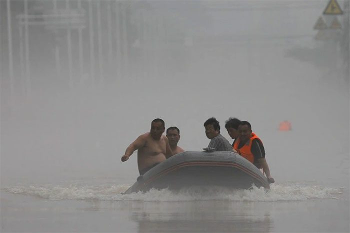
Yangtze River flooding in China set records in 2024, severely impacting several areas (Photo: SCMP).
According to Bo Yanchen, a geography professor at Beijing Normal University, China has now established a complete operational satellite system for disaster relief and prevention.
“China’s meteorological satellites are crucial for forecasting the development of storms and agricultural drought,” the expert shared. “They also play a vital role in risk zoning and damage assessment during natural disasters.”
Professor Weng stated that satellite technology capable of capturing clear images is extremely important, as it enhances the timeliness and accuracy of disaster monitoring.
By coordinating data from multi-source satellites, this method can even prevent disasters from recurring in areas frequently affected by extreme weather.
“By observing satellite imagery and computer models, scientists can assess areas and populations vulnerable to repeated disasters, thus implementing appropriate preventive measures,” Weng shared.
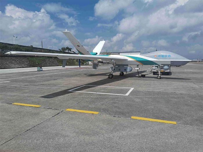
Drones used in disaster relief and weather research in China (Photo: China Daily).
Drones have also been deployed to mitigate the impact of the recent major flooding in Hunan, where more than 1,400 communication base stations were disrupted.
According to SCMP, the disruption caused by floods occurred during the university application period for students. Consequently, if communication could not be restored, many students risked missing out on their desired universities.
To address this issue, local authorities had to use drones to maintain communication between base stations and the public network.
Meanwhile, a new weather processing system based on radar called ROSE3.0 has improved the accuracy of weather warnings and rainfall monitoring. This system has now been installed at 123 radar stations, including those in Beijing and neighboring provinces.
Weng noted: “China has done an excellent job in building a high-speed rail network, highways, and aerospace infrastructure.”
“If these experiences can be utilized in constructing infrastructure to deal with extreme weather, China will perform better in disaster prevention and response.”
Vietnam Can Learn from China’s Approach
The lesson of using technology to combat natural disasters and extreme weather in China will serve as inspiration for developing countries in the region, including Vietnam.
According to the Vietnam Academy of Science and Technology, Vietnam’s first radar technology satellite, named LOTUSat-1, is nearing completion and is set to be launched into orbit by the end of 2024 or early 2025.
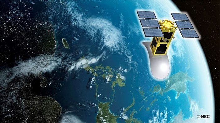
Simulation of LOTUSat-1 satellite (Photo: VNSC).
According to the Vietnam Space Center, LOTUSat-1 is an Earth observation satellite capable of capturing high-resolution images in all weather conditions using synthetic aperture radar (SAR) technology.
Unlike optical satellites, radar satellites can take pictures in all weather conditions, especially in clouds, fog, and low-light conditions.
Data from the satellite will help meet the urgent demand for imaging resources, providing accurate and timely information to respond to and mitigate the impacts of natural disasters and climate change, manage natural resources, and monitor the environment, thereby supporting socio-economic development.


