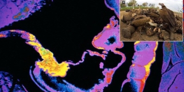
Images from orbital satellites and probes in 2022 provide new perspectives on Mars.
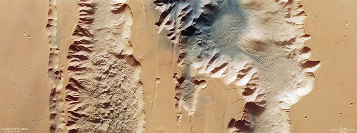
Captured by the Mars Express orbiter, this image shows Valles Marineris, a valley system that is ten times longer, twenty times wider, and five times deeper than the Grand Canyon on Earth. Aerial images demonstrate that the terrain of Mars is more diverse and treacherous than what humans observe from ground probes. (Photo: ESA).
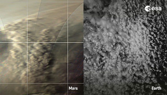
Dust storms at the North Pole of Mars, photographed by Mars Express. The clouds of the “Red Planet” (left) have a structure similar to clouds on Earth. This indicates that despite their differences, the two planets share some similarities. (Photo: ESA, EUMETSAT).
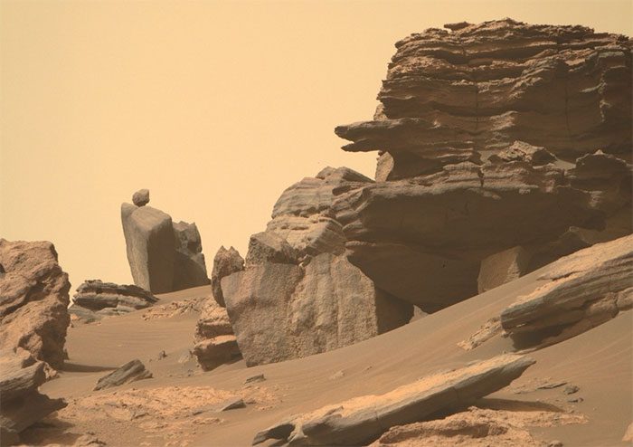
In June, NASA’s Perseverance rover captured images of an area within the Jezero plain. The left side of the photo features a slab of rock with a round stone balanced on top. On Earth, this type of rock is known as “Precariously Balanced Rock” (PBR). (Photo: NASA).
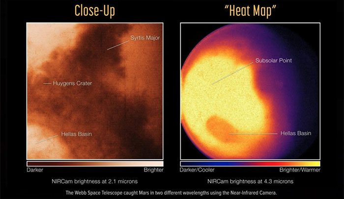
The surface of Mars as seen through the Near Infrared Camera (NIRCam) on the James Webb Space Telescope. Observed areas include the Huygens crater, the Hellas basin, and Syrtis Major – a “dark spot” at the boundary between low and high regions of Mars. (Photo: NASA).
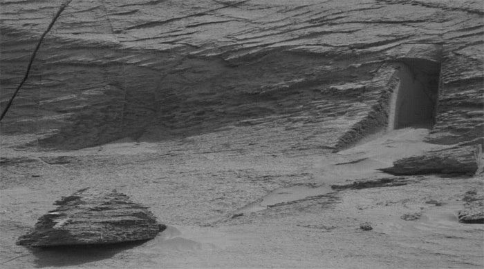
The Curiosity rover photographed a strange rock formation on Mount Sharp in May. Many hypotheses suggest this is an entrance to an alien base. However, NASA states that it is merely a natural crack in a boulder, approximately 30 cm high. (Photo: NASA).
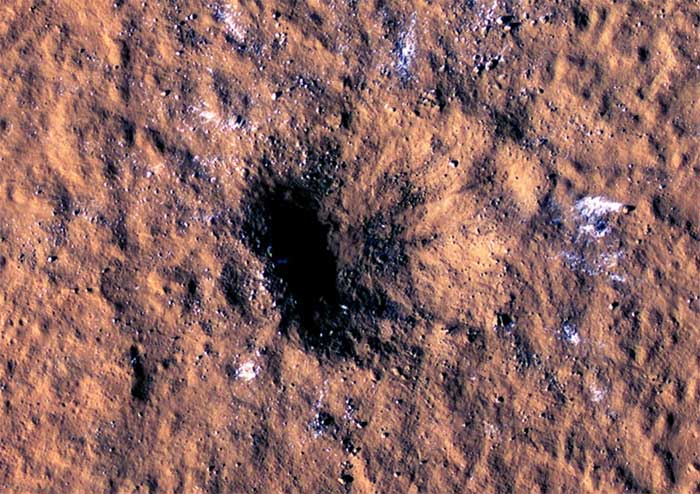
Captured by the High Resolution Imaging Experience (HiRISE) camera on the Mars Reconnaissance Orbiter (MRO), this image shows a crater on the surface of the “Red Planet”, created by a space meteorite on December 24, 2021. (Photo: NASA).
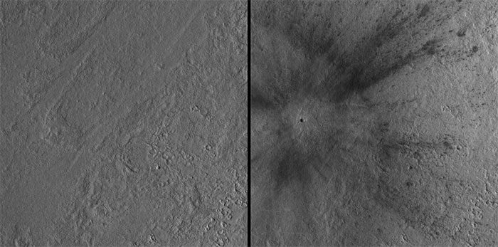
Another camera on the MRO, called the Context Camera, compared the terrain before and after the impact. According to Gizmodo, the meteorite struck a flat area known as Amazonis Planitia. The black dot on the left indicates where the meteorite fell, with impact effects radiating to surrounding areas. (Photo: NASA).
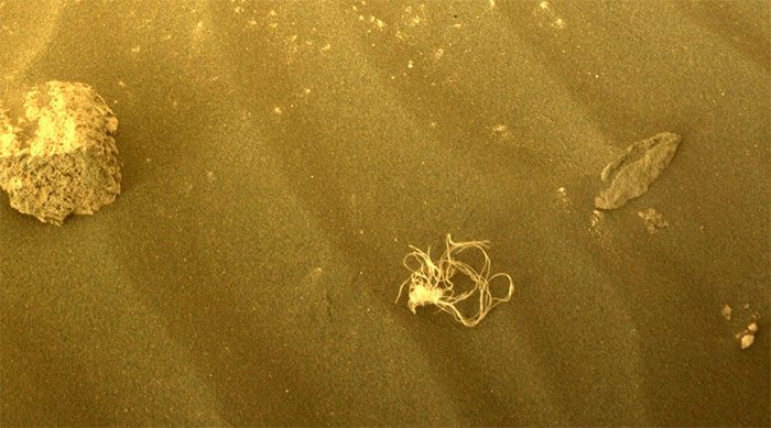
In July, the camera on the Perseverance rover captured an object resembling tangled string on Mars. According to NASA, this is debris left over from the landing process of the rover, although it cannot be confirmed what part it is. (Photo: NASA).
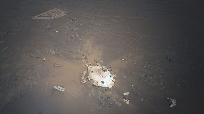
The Ingenuity helicopter photographed remnants of the parachute that helped Perseverance land on Mars. The rover landed in February 2021, and the debris was discovered in April this year. Compared to older observational devices, Ingenuity provides relatively sharp image quality. (Photo: NASA).
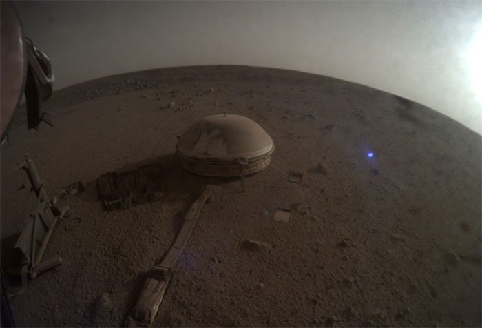
Image captured by the InSight lander on May 4, when the seismometer detected a strong earthquake on Mars. The earthquake’s magnitude was 5 on the Richter scale, comparable to what humans can feel but causing only minor damage. (Photo: NASA).
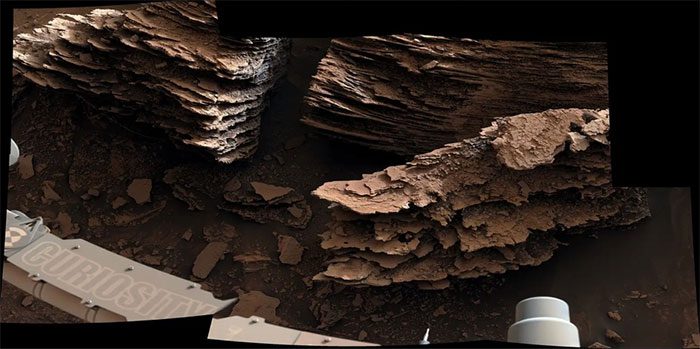
Rock formations at Mount Sharp recorded by the Curiosity rover. Scientists believe that Mars once had water, as the eroded rock layers indicate that water may have flowed through this area in the past. (Photo: NASA).
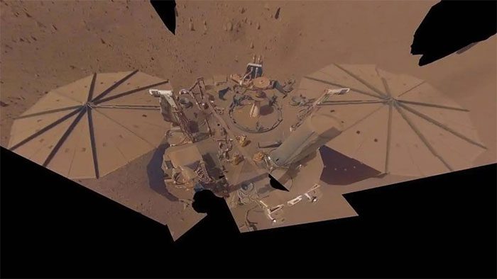
The last image from InSight shows dust on Mars covering the solar panels, causing the power on the lander to gradually deplete. The InSight team turned off the camera to extend operational time. This lander lost contact with Earth on December 19, marking the end of its mission after more than 4 years of operation. (Photo: NASA).


