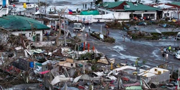
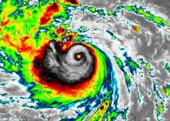
Experts recommend that fishermen and crew members regularly monitor weather forecasts through information channels and storm warning signal systems…
According to the National Center for Hydro-Meteorological Forecasting, on the afternoon of October 5, Tropical Storm Koinu entered the northeastern sea area of the North China Sea and became Storm No. 4 of 2023.
At 16:00, the center of Storm No. 4 was located at approximately 22 degrees North latitude; 119.7 degrees East longitude, about 370 km southeast of Guangdong (China).
The maximum wind speed near the center of the storm reached level 12 (118-133 km/h), with gusts up to level 15. The storm is moving westward at a speed of about 10 km/h.
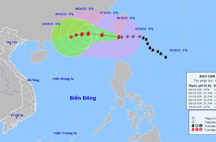
Storm path on October 5.
By 16:00 on October 6, the storm was about 140 km southeast of Guangdong (China) and gradually weakening. The maximum wind speed was level 10, with gusts up to level 13.
By 16:00 on October 7, the storm was moving westward at a speed of about 5-10 km/h, over the southeastern sea area of Guangdong (China). The maximum wind speed was level 8, with gusts up to level 11.
By 16:00 on October 8, the storm was moving west-southwest at about 5 km/h and weakened into a tropical depression. The maximum wind speed was level 6, with gusts up to level 8.
In the next 72-96 hours, the tropical depression will primarily move west-southwest at a speed of 5-10 km/h and weaken into a low-pressure area.
Due to the influence of Storm No. 4, the northeastern sea area of the North China Sea is experiencing strong winds of levels 7-10, with winds near the storm center reaching levels 11-12 and gusts of level 15; the sea is severely turbulent.
The North China Sea has waves reaching heights of 2-4 meters, while the northeastern area has waves as high as 4-6 meters, and near the storm center, waves can reach 6-8 meters.
According to the guidance from the Permanent Office of the National Steering Committee for Disaster Prevention and Control, in light of the strong winds and large waves in the northeastern sea area of the North China Sea, relevant authorities need to inform vessels and boats operating at sea about the developments, so they can proactively take precautions to ensure safety and plan appropriate production; maintain communication, and be ready with forces and equipment for rescue operations when necessary…
Experts advise fishermen and crew members to consistently monitor weather forecasts through information channels and storm warning signal systems…
On land, the National Center for Hydro-Meteorological Forecasting noted that from 16:40 to 21:40 on October 5, the provinces of Binh Dinh, Phu Yen, Khanh Hoa, Kon Tum, and Dak Lak continued to experience rain, with cumulative rainfall generally ranging from 20-40mm, with some areas exceeding 70mm.
There is a very high risk of flash floods occurring on rivers and small streams, as well as landslides on slopes in the aforementioned provinces, particularly in the districts of: Van Canh, Hoai An, Phu Cat (Binh Dinh province), Son Hoa (Phu Yen province), Khanh Vinh, Khanh Son, Van Ninh, Dien Khanh (Khanh Hoa province), Kon Plong, Tu Mo Rong, Dak Glei, Ngoc Hoi (Kon Tum province), Ea H’leo, M’Drắk, Ea Kar, Krong Bong (Dak Lak province).
Disaster risk warning level for flash floods, landslides, and subsidence due to rain floods or flows is level 1.
Flash floods and landslides can have severely negative impacts on the environment, threaten the lives of residents; cause localized traffic congestion, affecting the movement of vehicles; and destroy infrastructure, causing damage to production activities and socio-economic operations.
