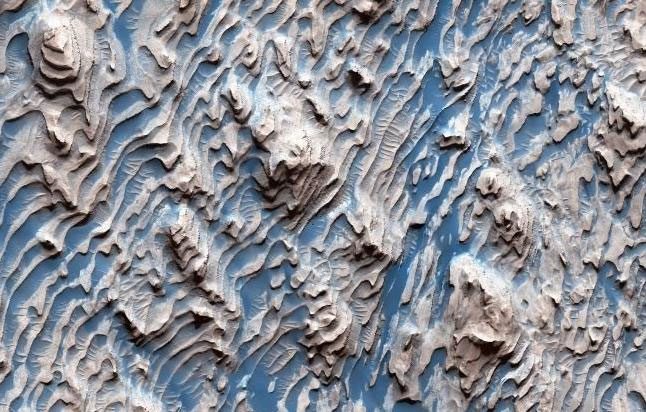
NASA has reported that images captured by the HiRISE satellite while flying over Danielson Crater reveal a geologically intriguing landscape.

Interesting landscape in the NASA photo just released – (Photo: NASA).
Although the actual landscape does not exhibit the visually appealing blue hues as enhanced by NASA, it clearly shows the fantastic arrangement of sedimentary layers that are relatively evenly spaced, with varying degrees of erosion.
The uniformity among these layers—despite being separated—indicates that they could not have been formed by random processes such as events and impacts. Instead, a cyclical phenomenon must have deposited the sediments.
These sedimentary layers were formed millions, even billions of years ago, as sediments gradually accumulated in the crater, layer by layer, and cemented in place. Faults were created when the sediments transitioned into rock.
According to Science Alert, NASA has proposed two hypotheses for the formation of this unique landscape: due to climate changes caused by cyclical variations in Mars’ orbit, or due to an underground water layer.
The underground water layer hypothesis is particularly intriguing, as wherever there is water, there is the potential for life. Mars is one of NASA’s top targets in the quest to find life beyond Earth.


