From June to September, Northern Vietnam is likely to directly experience the impact of two storms. The rainfall in the region during this period is also expected to be higher than in previous years.
According to the National Center for Hydro-Meteorological Forecasting, storms and tropical depressions are likely to appear in the South China Sea with a lower frequency than in previous years during June and July. This year’s storm season is expected to concentrate in the later months of the year.
Initial forecasts indicate that from now until the end of the year, there will be approximately 10-12 storms and tropical depressions in the South China Sea, of which 4-6 will directly affect our country, which is lower than the long-term average.
However, the influence of La Niña (cold phase of sea surface temperatures) could lead to a sudden occurrence of storms, including the possibility of strong storms with unusual paths.
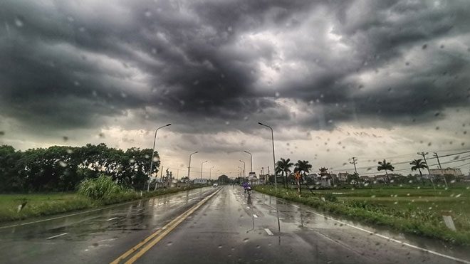
Tropical depressions or storms may appear in the South China Sea in the next two weeks.
Specifically for the Northern region, experts predict that from June to September, the area is likely to be directly affected by about 2 storms. Rainfall during this time is also expected to be higher than the long-term average.
In June, the total rainfall in Northern Vietnam is expected to be 10-20% higher than in the same period last year, with the Northwest and Viet Bac regions potentially recording rainfall increases of 20-30%. The situation of flooding in the northern mountainous areas in the coming months is also expected to be complex, posing risks to the safety of hydropower reservoirs in the Red River basin.
Currently, Northern Vietnam has begun to experience a heat wave after a series of rainy days. On June 3, the temperature in the Northern Delta, Son La, and Hoa Binh regions commonly reached 35-36 degrees Celsius, with some areas exceeding 36 degrees Celsius. The hottest part of the day lasts from 1 PM to 4 PM.
At the same time, the heat is increasing in the area from Thanh Hoa to Phu Yen, with temperatures reaching 35-37 degrees Celsius, and some places exceeding 38 degrees Celsius. The humidity is at its lowest between 50-65%.
The meteorological agency reports that Northern Vietnam will maintain hot weather until June 4, after which it will gradually cool down. In the Central region, the heat is expected to continue for the coming days.
Forecasts indicate that the number of hot days in June in Northern Vietnam will be lower than in the same period last year. Additionally, tropical depressions or storms are likely to appear in the South China Sea in the next two weeks.
Meanwhile, the Southwest monsoon is becoming more active with average to strong intensity, leading to many days of rain and thunderstorms in the Central Highlands and Southern regions.
This afternoon and evening (June 3), rain is expected to continue in the Central Highlands and Southern regions, with rainfall amounts of 20-40 mm, and localized heavy rain exceeding 60 mm, accompanied by the risk of whirlwinds, lightning, hail, and strong winds. Residents are advised to be cautious of the risk of flash floods, landslides in mountainous areas, and flooding in low-lying urban areas.
