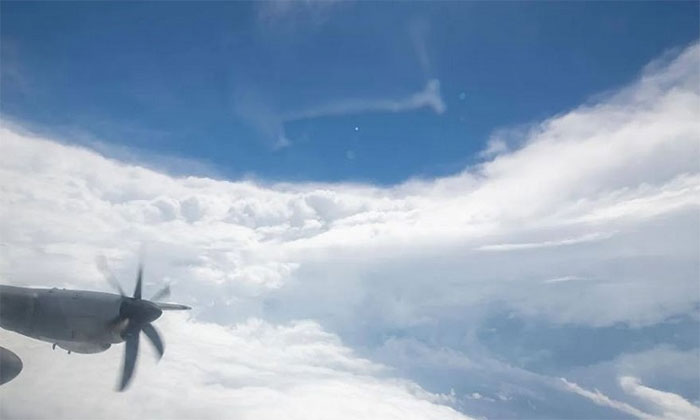
Pilots Fly Directly into the Eye of Dangerous Hurricane Ian Threatening Florida, USA, on September 27.
A team of storm chasers flies straight into the eye of Hurricane Ian. (Video: NOAA)
Hurricane Ian made landfall on the western coast of Florida on September 28, bringing strong winds, heavy rain, and the risk of storm surge and flooding. To study the hurricane, pilots flew directly into its center, capturing numerous videos and images throughout the flight.
The storm chasers from the National Oceanic and Atmospheric Administration (NOAA) are specialists who penetrate storms to gain a better understanding of their development, intensity, and movement. The NOAA aircraft operations center shared a video showing a specially equipped plane named Kermit flying into the eye of Hurricane Ian. In the video, the crew navigates through swirling clouds before entering the calm region at the storm’s center.

Video of a specially equipped plane named Kermit flying into the eye of Hurricane Ian.
“The flight into Hurricane Ian was the worst I have ever experienced. I have never seen so much lightning,” shared NOAA storm chaser Nick Underwood.
Local authorities are urging residents to evacuate. On the morning of September 28, the National Hurricane Center (NHC) reported that the circulation of Hurricane Ian was moving ashore. The NHC warned of storm surge and destructive waves along the southwestern coast of Florida from Englewood to Bonita Beach, including Charlotte Harbor. Ian was classified as a Category 4 hurricane on the Saffir-Simpson Hurricane Wind Scale, with winds reaching 250 km/h, just shy of Category 5. This scale is a method for assessing potential damage from hurricane winds.
NOAA and the U.S. Air Force storm chasers play a crucial role in understanding hurricanes and providing more accurate storm forecasts. The aircraft operate as airborne weather stations to collect real-time data on wind speed, wind direction, temperature, humidity, and pressure.


