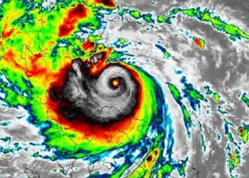
This morning, October 17, Typhoon No. 6 (Typhoon Nesat) is located approximately 720 km northeast of the Paracel Islands and is moving westward with wind speeds near the center of the storm reaching levels of 11-12, gusting up to 14.

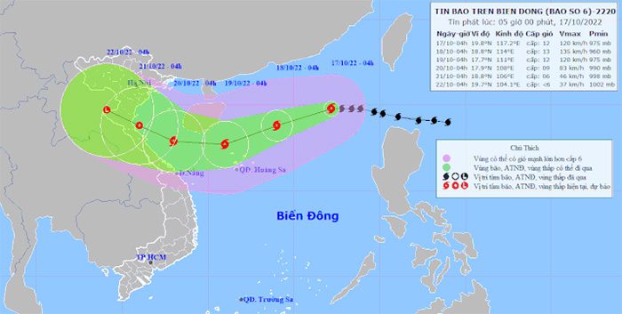
Forecast path of Typhoon No. 6 (Typhoon Nesat) – (Source: National Center for Hydro-Meteorological Forecasting).
As of 4 AM today, October 17, the center of Typhoon No. 6 is located approximately 720 km northeast of the Paracel Islands. The strongest winds near the center of the storm are at levels 11-12 (103-133 km/h), gusting up to 14, and it is moving west at a speed of about 20 km/h.
In the next 24 to 48 hours, Typhoon No. 6 is expected to move west-southwest at a speed of 15 km/h and may intensify further.
By 4 AM on October 18, Typhoon No. 6 will be approximately 380 km northeast of the Paracel Islands, with maximum wind speeds near the center reaching levels 12-13, gusting up to 15.
Around 4 AM on October 19, Typhoon No. 6 will be about 190 km north of the Paracel Islands, with wind speeds near the center at levels 11-12, gusting up to 14.
The risk level for natural disasters in the North East Sea area is rated at level 3.
From 48 to 72 hours ahead, the storm will primarily move westward, traveling at 10-15 km/h, with wind speeds near the center at levels 8-9, gusting up to 11.
From 72 to 96 hours ahead, the storm will primarily move west-northwest, traveling about 10 km/h and gradually weakening into a tropical depression, with a strength of level 6, gusting up to 8.
From 96 to 120 hours ahead, the tropical depression will continue to move primarily west-northwest, traveling about 10 km/h and continuing to weaken.
Warning of strong winds at sea
In the next 24 to 48 hours, the North East Sea area (including the waters around the Paracel Islands) will experience storms with strong winds at levels 9-10, increasing to levels 11-13, gusting up to 15.
The central part of the East Sea (including the waters north of the Spratly Islands) will see heavy rain and thunderstorms; winds will gradually increase to levels 6-7, then up to level 8, gusting to level 10.
Warning of storm surge and high waves
In the next 24 to 48 hours, in the North East Sea area, wave heights will reach 5-7 meters, with waves near the center of the storm reaching 8-10 meters. In the central part of the East Sea, wave heights will be 3-5 meters.


