Located at the intersection of several tectonic plates and fault lines, Turkey has become a hotspot for seismic activity.
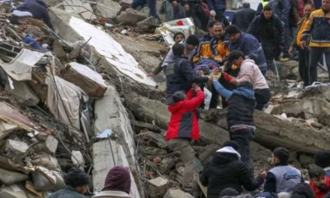
Recently, Turkey experienced a powerful earthquake near the city of Gaziantep, with its epicenter at a depth of 17.9 km. The quake destroyed numerous buildings, resulting in over 3,800 fatalities and more than 5,000 injuries, with nearly 900 buildings collapsing across various cities. Neighboring Syria reported at least 237 deaths and 639 injuries, according to the state news agency SANA, citing a health official. Over 1,000 volunteer rescue workers have been deployed. The cities most affected include Adana, Malatya, Gaziantep, Diyarbakır, Hatay, Adıyaman, Osmaniye, and Şanlıurfa.

Rescue team saving a citizen from a collapsed building in Adana, Turkey. (Photo: AP).
This is not the first time Turkey has faced such severe earthquakes. According to Stephen Hicks, a seismology researcher at Royal Holloway, University of London, this earthquake’s magnitude is comparable to the disaster that struck northeastern Turkey in December 1939. That earthquake, measuring 7.8 on the Richter scale, occurred near the city of Erzincan, destroying 116,720 buildings and resulting in 32,968 deaths. The frigid weather conditions also hampered rescue efforts.
Following the 1939 earthquake, Turkey experienced five more significant quakes from 1942 to 1967, culminating in a major earthquake in August 1999. On August 17, 1999, a quake measuring 7.4 struck near the city of Izmit in northeastern Turkey, killing tens of thousands and leaving 250,000 homeless. Istanbul, a city of over 7 million people located about 80 km northwest of the epicenter, also experienced severe shaking. The earthquake devastated Izmit and surrounding cities. In 2020 alone, Turkey’s Disaster and Emergency Management Authority recorded over 33,000 different earthquakes, including 322 quakes measuring 4 or higher on the Richter scale.
Approximately 98% of Turkey’s land area is prone to earthquakes, with about one-third of the country at high risk, including areas surrounding major cities like Istanbul and Izmir, as well as Eastern Anatolia. The majority of Turkey lies on the Anatolian tectonic plate, situated between the larger Eurasian and African plates and the smaller Arabian plate. As the African plate shifts and the Arabian plate moves, Turkey is squeezed, while the Eurasian plate restricts any northward movement. Consequently, Turkey is located on several fault lines. According to ABC, experts liken the North Anatolian Fault to a buttoned shirt being stretched. When one button pops, pressure shifts to the next button, increasing the likelihood of it popping as well.
The North Anatolian Fault, where the Anatolian plate meets the Eurasian plate, is considered the most destructive fault line, extending from southern Istanbul to northeastern Turkey. At the same time, the East Anatolian Fault stretches 650 km from the eastern Turkey plateau to the Mediterranean Sea. From there, it veers south, meeting the northern end of the Mid-Atlantic Ridge, which separates the African and Arabian tectonic plates.
For these reasons, Turkey has repeatedly suffered damage from earthquakes. However, the country is not adequately prepared to cope with such disasters. Some buildings, including structures in Istanbul, the country’s most modern and developed city, do not meet earthquake safety standards. Many homes are constructed with poor oversight during construction and low-quality materials. Ongoing disputes between the Kurdistan Workers’ Party (PKK) and the Turkish military have forced many villagers to abandon their homes and land, relocating to makeshift houses in cities and towns. These homes are prone to collapse during earthquakes, leading to even greater damage.


