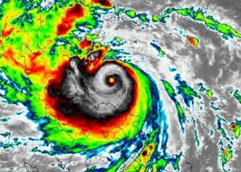
Due to the impact of Typhoon No. 5 (Conson), this morning (September 11), provinces from Quang Tri to Quang Ngai experienced strong winds accompanied by heavy rainfall, with some areas receiving very heavy rain of up to 350 mm per event.
Regarding the latest developments of Typhoon No. 5 (internationally named Conson), this morning (September 11), in an interview with reporters, Mr. Mai Van Khiem, Director of the National Center for Hydro-Meteorological Forecasting, stated: Due to the influence of Typhoon No. 5, the Ly Son Island station (Quang Ngai) recorded strong winds of level 7, gusting at level 10. The area from Thua Thien Hue to Binh Dinh has experienced heavy rain, with some places receiving very heavy rain of 50-100 mm, and some areas exceeding 150 mm.
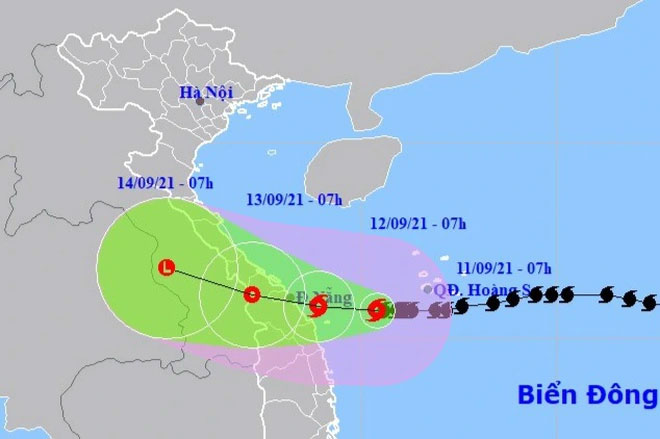
Position and movement direction of Typhoon No. 5. (Photo: NCHMF).
“At 7 AM on September 11, the center of the typhoon was located about 210 km off the coast of Quang Tri – Quang Ngai to the east. The strongest winds near the center of the typhoon reached levels 9-10 (75-100 km/h), with gusts up to level 12. The radius of strong winds of level 6 and gusts of level 8 and above extends about 160 km from the center of the typhoon,” Mr. Khiem said.
Regarding the next forecast, Mr. Khiem indicated that in the next 24 hours, the typhoon will move slowly westward at a speed of about 5 km per hour. By 7 AM on September 12, the center of the typhoon will be over the sea area from Quang Tri to Quang Nam. The strongest winds near the center will be at levels 8-9 (60-90 km/h), with gusts of level 11. Thus, the typhoon will weaken compared to yesterday (September 10) and early this morning.
According to Mr. Khiem, after the typhoon moves into the sea area from Quang Tri to Quang Nam, it will proceed westward at a speed of 5-10 km per hour, weakening into a tropical depression as it moves inland. It is forecasted that by 7 AM on September 13, the center of the depression will be located in the Vietnam-Laos border area. The strongest winds near the center of the tropical depression will be at level 6 (40-50 km/h), with gusts of level 8.
Regarding warnings of strong winds and high waves at sea, Mr. Khiem stated that today and tonight (September 11), in the western sea area of the North and Central East Sea (including the southwestern sea area of the Paracel Islands), heavy rain and strong winds of levels 8-9, with gusts at level 10 near the center of the typhoon, and gusts up to level 12 are expected; sea waves will be high from 4.0-6.0 m; the sea will be very rough. In the sea area from Quang Tri to Quang Ngai (including Ly Son and Con Co Islands), winds will gradually increase to levels 6-7, then rise to levels 8-9, with gusts at level 11; sea waves will be high from 4.0-5.0 m; the sea will be very rough.
Additionally, on land, starting today (September 11), coastal areas from Quang Tri to Quang Nam will experience increasing winds of levels 6-7, with levels 8 near the center of the typhoon and gusts at level 10; inland areas will have gusts of levels 7-8.
Concerning heavy rainfall on land, Mr. Khiem particularly noted that from now until September 13, provinces from Quang Tri to Quang Ngai will experience heavy to very heavy rain, with rainfall in Quang Tri to Quang Nam generally reaching 200-300 mm per event, with some areas exceeding 350 mm per event, and Quang Ngai generally receiving 100-200 mm per event, with some areas exceeding 200 mm per event.
From September 12 to 14, provinces from Quang Binh to Thanh Hoa will experience moderate to heavy rain, with some areas experiencing very heavy rain, with rainfall generally reaching 100-200 mm per event, particularly in Quang Binh and Ha Tinh where some areas may exceed 250 mm per event.
“Today and tomorrow, the provinces of Binh Dinh, Kon Tum, and Gia Lai will experience moderate to heavy rain, with some areas receiving very heavy rain, generally reaching 50-80 mm per event, with some areas exceeding 100 mm per event,” Mr. Khiem added.
