These images partially illustrate the terrifying impact of climate change on life on Earth.
We all know that the situation regarding climate change is becoming increasingly complex. Scientists report that humans are one of the major factors driving global warming, leading to the greenhouse effect.
The most evident manifestation of global warming is the increased melting of ice, rising sea levels, and a series of unusual weather phenomena such as storms, floods, tsunamis, earthquakes, prolonged droughts, and extreme cold… resulting in food shortages and the emergence of various diseases in humans and livestock.
The following images will help viewers realize the many direct and indirect impacts that climate change is having on regions around the world.
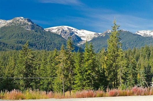
This image shows Rocky Mountain National Park in the past – majestic pine trees stretching over tens of millions of square meters in the Northwestern United States and Western Canada.
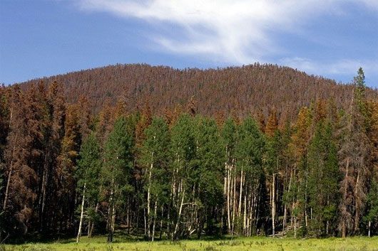
And this is the image of Rocky Mountain National Park today – one side of the pine slope has died due to insect infestations, and the trees appear more desolate. According to scientists, the rising temperatures have allowed insects to thrive, attacking and devastating the pine forests here.
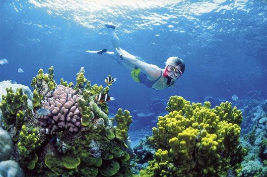
The Great Barrier Reef, which stretches 2,600 km off the coast of Australia, was once considered one of the most diverse biospheres in the world. It is made up of approximately 3,000 reefs, billions of small living organisms, and 900 islands.
However, this World Heritage Site is severely deteriorating due to global warming. Ocean acidification and rising temperatures caused by climate change pose the greatest threat to the reefs here.
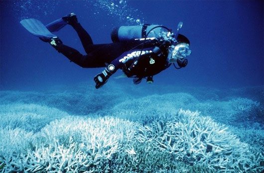
The above image shows the Great Barrier Reef gradually deteriorating. Half of the corals in the Great Barrier have disappeared in the last three decades. Ocean acidification has also led to mass bleaching of the corals. When corals turn white, they become more sensitive and likely to die. This has severely impacted the underwater ecological environment.
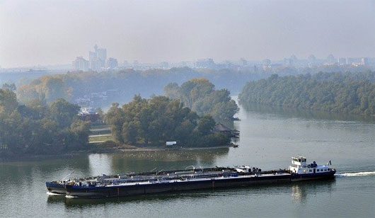
The image above shows a section of the Danube River – the second-longest river in Europe, originating in Germany and flowing east to the Black Sea in Romania. It is one of the important gateways for trade and maritime industry.

However, few people know that under the influence of climate change, a prolonged drought in 2011-2012 caused the water level of the Danube River to drop to a record low. This caused ships to be stranded and the heavily trafficked waterway to become paralyzed.
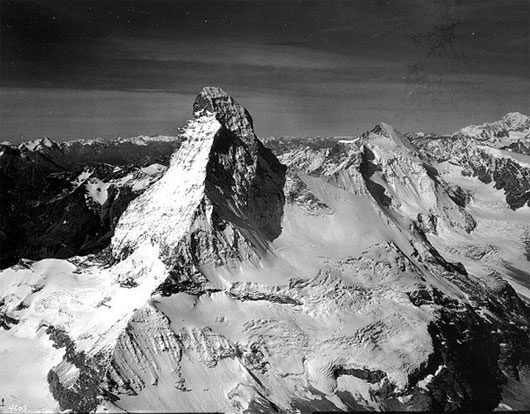
The image above captures the Matterhorn – one of the highest peaks in Europe, located in the Alps on the border of Italy and Switzerland. The photo depicts a large snow and ice mass taken on August 16, 1960.
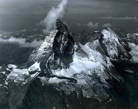
But the photo taken on August 18, 2005, shows that the “roof of Switzerland” is eroding. This consequence is due to the increased melting of large ice masses.
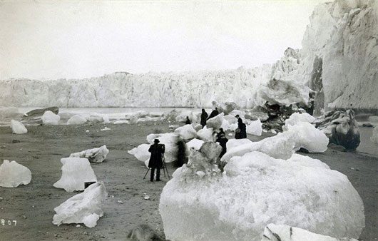
This is a photograph of the Muir Glacier in Alaska taken in the late 19th century. You can see many icebergs in the foreground – some nearly 2.1 m wide.
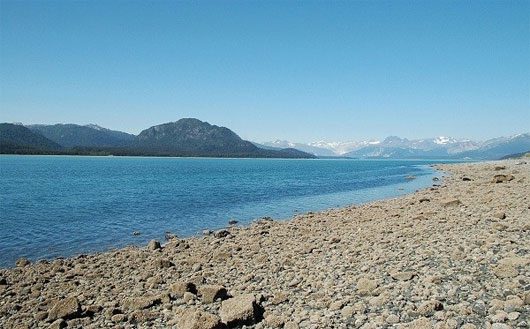
But few realize that the Muir Glacier today looks like this. The photo was taken from the same position as the previous image, but the glacier has almost vanished from sight. Instead, there is a lush vegetation growth, and the shores are covered with gravel – formed from sediments deposited as the ice melts on the ground.
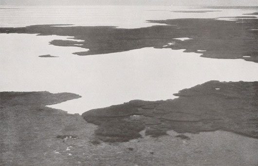
The photo of Lake Chad in Africa was taken in the 1930s. It was once the sixth-largest lake in the world, providing water for at least 20 million people in Nigeria, Chad, Cameroon, and Niger.
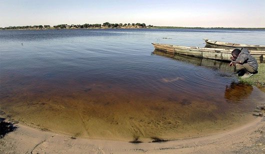
Today, Lake Chad has lost about 80% of its surface area. This is the result of a combination of impacts from irrigation systems, dam constructions on rivers, and global warming.
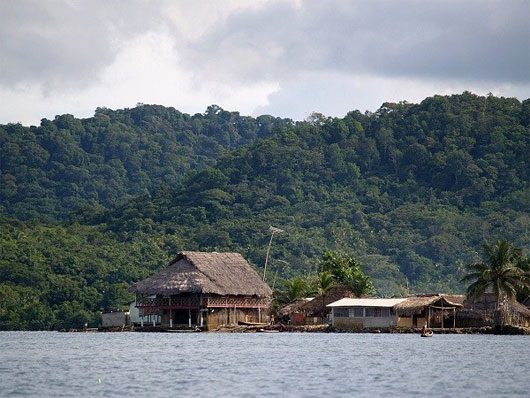
The San Blas Islands in Panama are home to the Guna people. The shabby thatched huts and the livelihoods of the residents living in floating homes are threatened by climate change.

Today, the community living on these islands faces prolonged flooding every rainy season. This is a result of rising sea levels as the Earth warms.
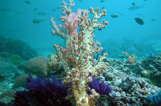
This image captures the coral reefs at Dibba. In 2004, the coral reef along the eastern coast of the United Arab Emirates (UAE) was vibrant with color.
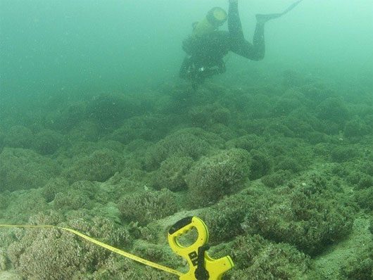
Today, coral reefs are devastated by a harmful type of algae known as red tide. This algae has the ability to aggregate, increasing greenhouse gases, raising ocean temperatures, and killing many marine creatures by reducing the amount of dissolved oxygen in the water.
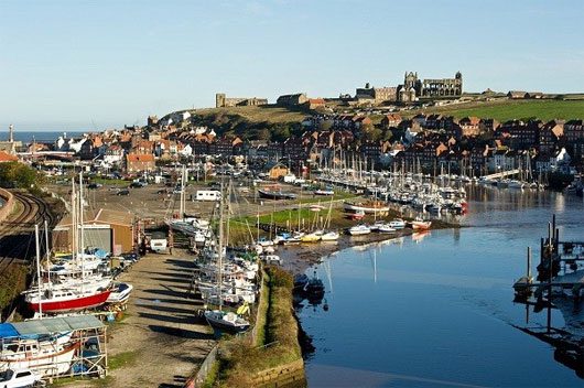
Previously, the town of Whitby Harbor in Northern England was a bustling town filled with fishing activities, boats, merchants, and tourists.
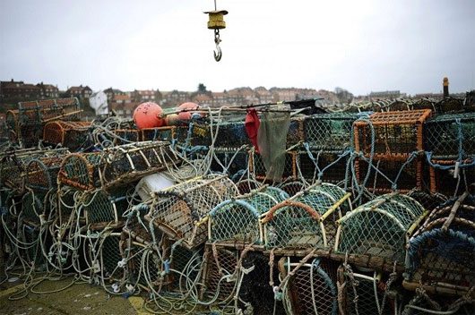
However, today, this harbor area is extremely quiet and desolate, with fishing nets and boats left abandoned. The cause of this desolation is the migration of fish to other regions. Now, only about 200 fishermen remain in Whitby.
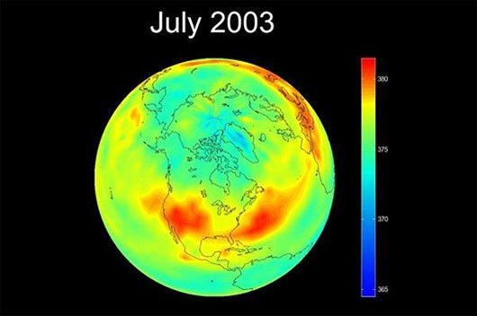
The image shows the concentration of CO2 in the atmosphere on Earth in 2003. The red areas indicate CO2 levels at 380ppm (a measurement unit to express concentration by mass, measured in parts per million).
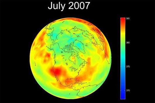
The following image, taken in 2007, shows that atmospheric CO2 levels on Earth are rising. The density of the red areas has significantly increased, indicating that many regions on Earth are emitting more CO2—a result of burning fossil fuels and deforestation. CO2 is a greenhouse gas that enhances the greenhouse effect in the atmosphere, leading to global warming.
What Can You Do to Reduce CO2 Emissions to Help the Earth “Slow” Down Global Warming, Just by Everyday Actions?
– Gradually switch to walking, cycling, or using buses instead of relying on motorcycles or cars for transportation.
– Look for ways to limit the use of energy from firewood/coal or gas. Instead, we can explore the use of solar energy.
– Actively plant green trees (each of you can plant a small ornamental tree both for decoration and to help create a cleaner environment).


