The sea “consumes” the land or the land “consumes” the sea, resulting in the formation of coastal bays. Worldwide, there are four bays with an area of over 1 million km2, with the Bay of Bengal in the northeastern Indian Ocean being the only one exceeding 2 million km2.
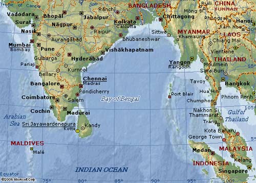
The Bay of Bengal is located between the Indian Peninsula, the Southeast Peninsula, the Andaman Islands, and the Nicobar Islands. Its total area is 2.173 million km2, with an average depth of 2,586 meters. The water temperature ranges from 25 to 27 degrees Celsius, with the Ganges and Brahmaputra Rivers flowing into the northern part of the bay, creating wide river mouths. Within the bay, there are the Andaman and Nicobar Islands. Important ports include Chennai in India and Chittagong in Bangladesh.

Map of the Bay of Bengal region (Photo: encarta.msn)
The Bay of Bengal is known for harboring tropical storms. It is commonly believed that storms originate from the tropical waters between 5o and 25o North latitude. Pacific typhoons usually strike the Philippines, China, and Japan, while Atlantic hurricanes often hit the United States and Mexico. Every year, from April to October, which includes the summer and autumn seasons, storms frequently occur, accompanied by rising tides that generate massive waves into the Ganges and Brahmaputra Rivers, leading to severe flooding. On November 12, 1970, a storm caused significant devastation to the people of Bengal (India and Bangladesh), claiming 300,000 lives and leaving millions homeless.


