Finally, scientists have created a map of the mysterious eighth continent, Zealandia, to uncover the secrets of a lost land.
After decades of research, a team of scientists has completed the map of Zealandia. This map will help them unlock the mysteries of this enigmatic continent.
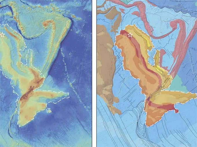
The scientists have obtained a complete map of Zealandia. (Photo: Nick Mortimer/GNS Science).
Zealandia is also known as the eighth continent of Earth. It covers an area of over 5 million km2, roughly half the size of Australia.
However, this land has been submerged for thousands of years, with 95% of its area lying underwater. This makes mapping it extremely challenging, as most of its volcanoes, valleys, and mountain ranges are located on the ocean floor near New Zealand.
Despite these challenges, scientist Nick Mortimer, who leads the research team, has tirelessly worked for over 20 years to uncover this strange land.
In a recent study, the team completed mapping the last remaining area of the continent, specifically the northeastern region.
Combining data collected over many years, the scientists have mapped the surface of this continent, including plateaus, mountain ranges, and the boundaries where land meets ocean. They believe this is a more detailed map than any other continent on Earth.
Decades of Work to Establish Zealandia as a Continent
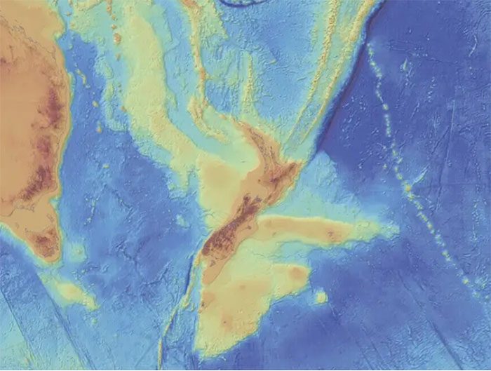
The depth map of Zealandia, with darker blue indicating deeper water. (Photo: Nick Mortimer/GNS Science).
Some argue that Zealandia should not be classified as a continent because too much of its area is submerged. Others recognize it as a fragment of a continent or a subcontinent.
For geologists, the definition of a continent does not necessarily have to be tied to sea level. In addition to size and defined boundaries between land and sea, another crucial factor is the crust of the land.
A typical continent features a thicker crust and various geological characteristics formed from granite, schist, limestone, and quartz, compared to the ocean floor.
To understand the geology of Zealandia, scientists worldwide have collaborated and used a combination of data obtained from satellites, radar, and rock samples from the region. In 2019, the research team mapped the southern boundaries of Zealandia.
Based on years of research and evidence collected over time, the team believes they can now declare Zealandia as a continent, even though it is a hidden continent, shrouded in more mystery than others. Additionally, researchers want to understand what the entirety of Zealandia looks like, from its volcanoes and mountain ranges to its geological shelf, which is the oldest crust forming the foundation of this land.
Mapping the Geology of Zealandia
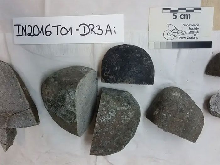
Granite samples from North Zealandia. (Photo: Nick Mortimer/GNS Science).
By completing the mapping of the northeastern part of this continent, the researchers finalized the last piece of the entire continent’s map. They collected and dated basalt and cobble samples from the seabed of the Fairway Ridge area of Zealandia, located in the Coral Sea northwest of New Caledonia. The ages of the geological components in this area range from approximately 36 million to 128 million years.
Through the collection of rock samples and mapping their locations on Zealandia, the team could infer geological forces, such as when volcanic formations and crustal submergence occurred.
The depth map shows that the basement geology of Zealandia becomes progressively younger, ranging from the Paleozoic era to the Permian-Mesozoic period. The data has helped geologists understand what happened when Zealandia broke away from a larger landmass.
Zealandia: A Relative of Antarctica
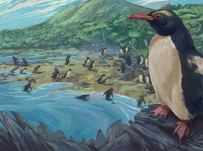
Illustration of the first penguins in New Zealand, 3 million years ago. (Photo: Simone Giovanardi/Massey University).
Geologist Mortimer describes Zealandia as a fragment of the supercontinent Gondwana.
For a long time, geologists have known Gondwana as a supercontinent that included present-day Antarctica, Australia, South America, Africa, and India. This supercontinent began to break apart during the Late Jurassic period, about 160 million years ago.
The geography of Zealandia’s shelf indicates that its connection to the former supercontinent was along the coasts of Australia and Antarctica. Beneath the ice sheet, much of West Antarctica is submerged. Approximately 100 million years ago, both Antarctica and Zealandia were still connected to Gondwana in a stretched state, “like a pizza dough being pulled.” Mortimer explains, “they spread wider but became thinner.”
As that crust cooled and thinned, Zealandia began to sink into the water and continued to submerge until about 25 million years ago. Meanwhile, the uplifted crust formed mountains and islands, although New Zealand may never have been entirely submerged.
Geologist Mortimer states that incorporating Zealandia into the continental data set will help us better understand why continents break apart, while also providing biologists with essential information about the flora and fauna living in Zealandia.
Many questions remain unanswered, but now that geologists have a basic idea of Zealandia’s shape and geology, they can shape deeper research projects to address when, how, and why various phenomena occurred in this land.


