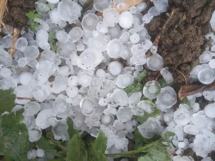
On the afternoon of March 29, in the city of Yên Bái and the districts of Yên Bình, Văn Yên, and Văn Chấn, an unusual phenomenon occurred where the sky suddenly turned pitch black. This was immediately followed by a sudden rainstorm accompanied by strong winds. This occurrence attracted considerable attention on social media, as many were surprised by this phenomenon which had first appeared on the afternoon of March 28.
Possibility of Hailstorms on April 5-6
At 7 a.m. on March 29, the city of Vinh (Nghệ An) experienced rain, and the sky also darkened as if it were nighttime, prompting vehicles to turn on their lights to navigate. The sky turned dark along with rain and wind, even though it had previously been clear.

Heavy hail has continuously appeared in several northern mountainous provinces in recent days.
Dr. Nguyễn Ngọc Huy, an expert on climate change and disaster warning, stated that this phenomenon is due to the significant temperature difference between atmospheric layers. The period from March 31 to April 4 is expected to bring a heat wave, increasing surface temperatures and promoting water evaporation.
The sudden darkening of the sky followed by hail may recur on April 5 or 6 in northern provinces. Specifically, by April 5 or 6, the arrival of cold air will cause high-density moisture condensation, forming cloud columns rising 8,000 to 10,000 meters, where water vapor crystallizes into ice crystals. These ice crystals, under the force of gravity, fall to lower layers but are pushed back up by the heat from the ground into colder upper layers, crystallizing more moisture until they become large enough to overcome the upward force of the heat and fall to the ground as hail.
When observing a pitch-black sky, it indicates that dense, high cloud columns are blocking sunlight. At this time, people should seek shelter indoors and move vehicles to covered areas to avoid damage to glass or lights. Hail, if it occurs, typically lasts only about 20 minutes and usually does not repeat in the same location on the same day.
Preventing Damage from Hail
Mr. Vũ Anh Tuấn, Deputy Head of the Weather Forecasting Department at the National Center for Meteorological and Hydrological Forecasting, stated that the northern mountainous provinces are experiencing the effects of three weather patterns. These include weak cold air continuously intensifying in the North, the expansion of a hot low-pressure area from the west, and wind convergence at an altitude of 5,000 meters moving from west to east.
“The combination of these three factors creates significant air disturbances in the Northern region, especially in mountainous provinces,” Mr. Tuấn remarked, noting that this phenomenon is not unusual. Hail typically occurs during transitional seasons from cold to warm (from February to May) or vice versa from warm to cold (October to November).
According to experts, forecasting thunderstorms and hail is relatively challenging because it requires identifying areas of wind convergence as well as significant air disturbances. Even if a disturbed area is identified, it does not guarantee that thunderstorms or hail will occur. Currently, meteorological agencies can only provide forecasts 24 hours in advance and issue warnings 30 minutes to 3 hours prior for specific areas.
To minimize damage from hail, the National Steering Committee for Disaster Prevention advises people to recognize the signs. These include dark, mammiform clouds approaching, strong winds, and a sharp decrease in air temperature. If caught outside during a hailstorm, individuals should stop and seek shelter, wear helmets to protect against falling hail, and wait for the hail on the road to melt before continuing to avoid slipping.
Residents should regularly check the condition of their roofs and reinforce them, using materials that can withstand impacts in critical areas. Roofs should slope down on both sides to reduce the force of hail impact. For crops susceptible to damage, residents can set up protective canopies along the rows.
| During the hot and humid phase, the moisture content in the air is high. The atmosphere at lower levels receives a lot of thermal energy, heating up and forming a column of hot air below and cold air above. At this point, convection occurs, creating cumulonimbus clouds. The upward air currents within the cloud are very strong, supporting ice particles that grow larger and eventually form layered hailstones. When the hailstones reach a size that the upward currents can no longer support, they fall to the ground, resulting in hail. |


