Mars is a planet of dramatic contrasts – the largest volcanoes in the solar system and deep valleys. But it will be a fantastic destination for future travelers.
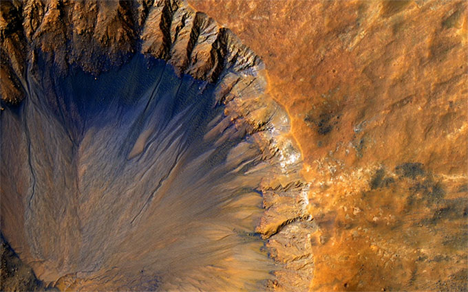
Impact crater in the Sirenum Fossae region on Mars, captured by NASA’s Mars Reconnaissance Orbiter on May 30, 2015. (Photo: NASA)
The landing sites for future Mars missions will likely need to be flat areas for safety reasons, but if we take a bit more time, we might be able to land tourists in some more geologically interesting regions.
Below are some captivating locations that future Mars travelers may visit.
1. The Giant Volcano Olympus Mons
Olympus Mons is the most extreme volcano in the solar system. Located in the Tharsis volcanic region, it is roughly the size of the state of Arizona in the United States. This volcano stands 25 km high, nearly three times the height of Earth’s Mount Everest (8.9 km).
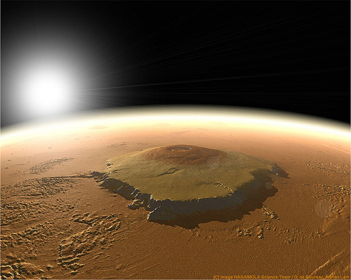
Olympus Mons as a giant shield. (Photo: NASA)
Olympus Mons is a massive shield volcano formed by lava flowing down its slopes.
This also means that the mountain may be relatively easy for explorers to climb, as its average slope is only 5%. At the summit of Olympus Mons is a spectacular caldera, approximately 85 km wide, formed by magma chambers losing lava (possibly during an eruption) and collapsing.
2. The Tharsis Volcanoes
While climbing to the summit of Olympus Mons, travelers should take a detour to view some of the other volcanoes in the Tharsis region.
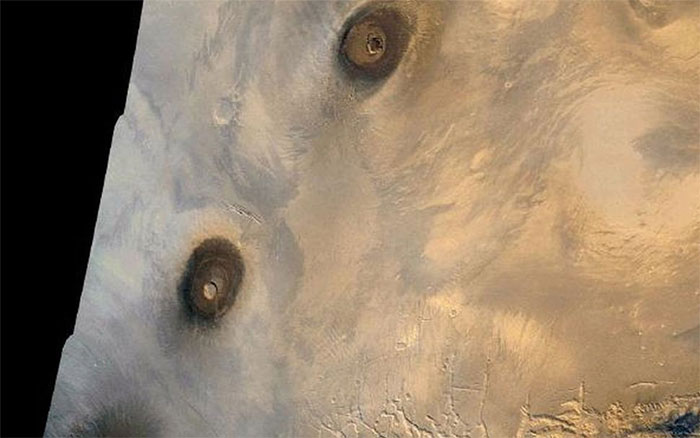
Some giant volcanoes in the Tharsis region of Mars captured by NASA’s Viking 1 spacecraft.
According to NASA, Tharsis contains 12 giant volcanoes in an area approximately 4,000 km wide.
Like Olympus Mons, these volcanoes tend to be much larger than those on Earth, perhaps due to Mars’ weaker gravity, allowing the volcanoes to grow taller. These massive volcanoes may have erupted for about 2 billion years, equivalent to half of Mars’ history.
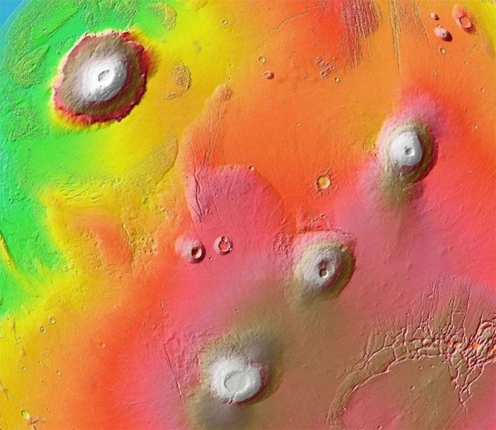
The Tharsis region, 1,700 km wide, featuring Olympus Mons (top left) and several other volcanoes, color-coded by terrain. (Photo: NASA).
The image above shows the eastern Tharsis region, captured by Viking 1 in 1980. On the left, from top to bottom, is the massive Olympus Mons; to the right and below are three shield volcanoes approximately 25 km high: Ascraeus Mons, Pavonis Mons, and Arsia Mons.
3. Valles Marineris Canyon
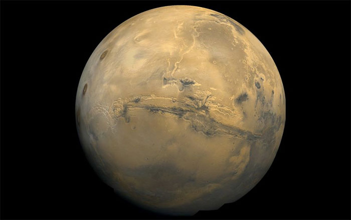
The 3,000 km long Valles Marineris canyon on the surface of Mars. (Photo: NASA)
Mars not only has the largest volcano in the solar system but also the largest canyon. Valles Marineris stretches about 3,000 km, roughly four times the size of the Grand Canyon in the United States, which is 800 km long.
Researchers are unclear how Valles Marineris formed, but there are several hypotheses regarding its development. Many scientists believe that when the Tharsis region formed, it contributed to the development of Valles Marineris.
Lava moving through the volcanic region pushed the crust upward, causing it to crack into fault lines. Over time, these fractures developed into Valles Marineris.
4. The Martian Poles
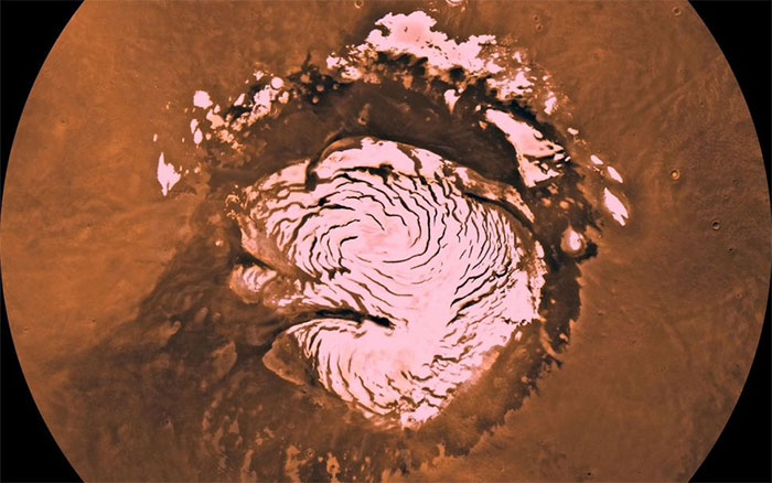
Mars has two ice caps at its poles.
Mars has two ice caps at its poles, with slightly different compositions; the North Pole (shown in the image) was closely studied by the Phoenix lander in 2008, while observations of the South Pole were conducted by orbiters.
During winter, temperatures near the North and South Poles of Mars are extremely cold, causing carbon dioxide (CO2) to condense out of the atmosphere into ice on the planet’s surface.
This process reverses in summer when CO2 sublimates back into the atmosphere. Carbon dioxide disappears completely in the Northern Hemisphere, leaving behind an ice cap. However, some CO2 ice remains in the Southern Hemisphere. All these movements of ice significantly impact the climate on Mars, creating winds and other effects.
5. Gale Crater and Mount Sharp
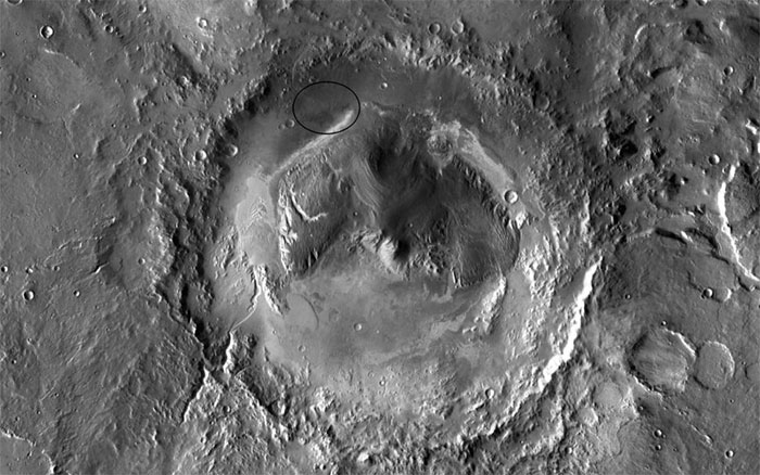
Famous after the landing of the Curiosity rover in 2012, Gale Crater is a site that holds evidence of past water existence.
The Curiosity rover accidentally discovered a streambed within weeks of landing and found additional impressive evidence of water throughout its journey along the bottom of this crater. Curiosity is currently exploring a nearby volcano called Mount Sharp (or Aeolis Mons) and studying the geological features in each of its layers.
One of Curiosity’s more intriguing discoveries is the repeated detection of complex organic molecules in the area. In 2018, NASA announced results showing that these organic compounds were found within rocks aged 3.5 billion years.
Alongside the organic findings, researchers also reported that the rover detected seasonal fluctuations in methane concentrations in the atmosphere. Methane is a compound that can be produced by bacteria as well as geological phenomena, so its discovery raises the hypothesis that it could be a sign of life.
6. Medusae Fossae
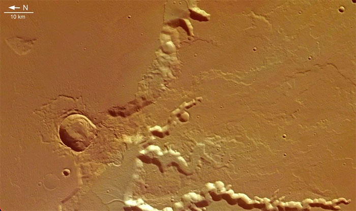
The formation of Medusae Fossae may stem from volcanic eruptions.
Medusae Fossae is one of the strangest locations on Mars. Some have even speculated that the terrain here was caused by an incident involving a UFO (unidentified flying object).
A more credible hypothesis suggests that it is a massive volcanic deposit, covering an area equivalent to one-fifth of the United States. Over time, winds have shaped the rocks here into stunning formations. However, scientists need to conduct further research to understand how the volcanoes formed Medusae Fossae.
A 2018 study suggested that the formation of Medusae Fossae could result from enormous volcanic eruptions occurring hundreds of times over more than 500 million years on Mars. These eruptions would have warmed the climate of the Red Planet as greenhouse gases from the volcanoes entered the atmosphere.
7. “Recurring Slope Lineae” at Hale Crater
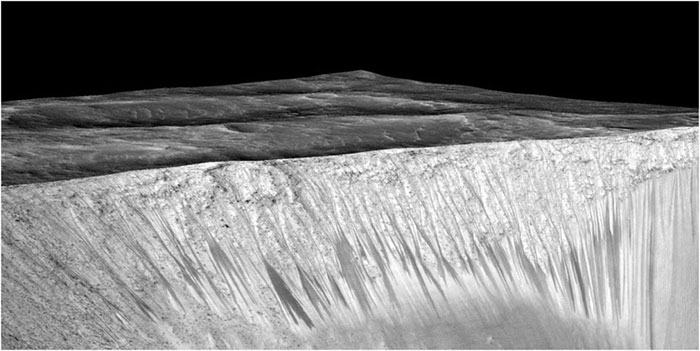
Recurring slope lineae on Mars.
Mars is home to strange geological regions known as recurring slope lineae (RSL), which tend to form on the steep walls of craters when the weather warms up.
However, it is challenging to pinpoint these RSLs. The images here taken from Hale Crater show spots where spectroscopy has detected signs of hydration.
In 2015, NASA initially reported that hydrated salts must be signs of water flowing on the surface, but later studies indicated that RSLs could form from atmospheric water or dry sand flows.
In fact, we may be able to get close to these RSLs to see what they really are. But that also poses a challenge, as if RSLs do contain extraterrestrial bacteria, we wouldn’t want to get too close for fear of contamination. Future Mars explorers may have to admire this mysterious terrain from a distance using binoculars.
“Phantom Dunes” in Noctis Labyrinthus and Hellas Basin
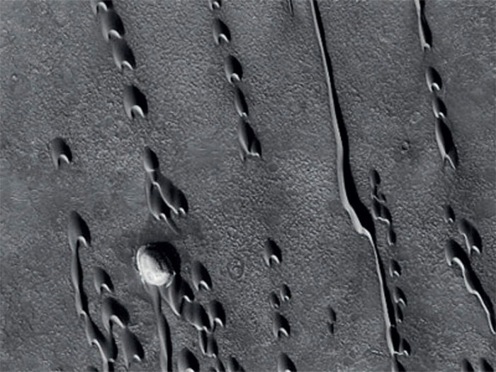
Mysterious dunes on Mars. (Photo: NASA)
Today, Mars is a planet primarily shaped by wind, as its water has completely evaporated due to its thin atmosphere. However, we can see ample evidence of water sources in the past, such as the “phantom dunes” found in the Noctis Labyrinthus and Hellas basins. Researchers indicate that these areas once had sand dunes towering tens of meters high. Subsequently, these dunes were buried by lava or water, preserving their bases while their tops have eroded.
These ancient sand dunes illustrate how wind once blew across ancient Mars, providing climatologists with insights into the Red Planet’s ancient environment. In an even more intriguing twist, there may be bacteria hiding in areas sheltered by these sand dunes, protecting them from radiation and wind erosion.


