Floods and landslides have severely devastated the West Coast of Canada and the United States just months after a record-breaking heatwave, raising further alarms about the worsening state of climate change.
What is Happening?
The Pacific Northwest is a coastal region located in the western part of North America. The largest cities in the area include Vancouver, British Columbia (Canada); Seattle, Washington; and Portland, Oregon (United States).
Since September, heavy storms have dumped record rainfall on the wetlands of British Columbia (Canada) and Washington state (United States).
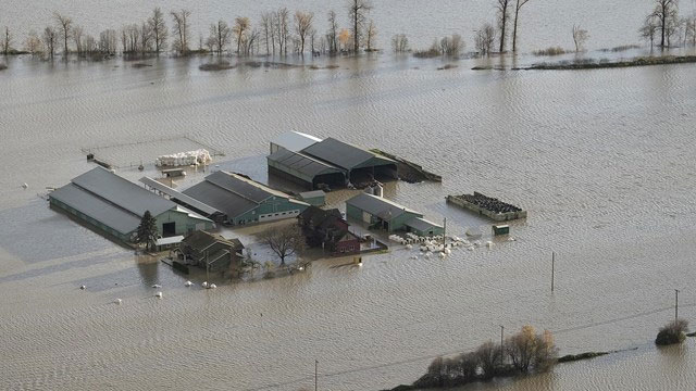
The flood submerged the city of Vancouver in British Columbia, Canada. (Photo: Euronews).
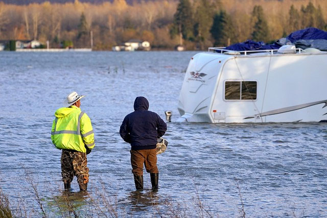
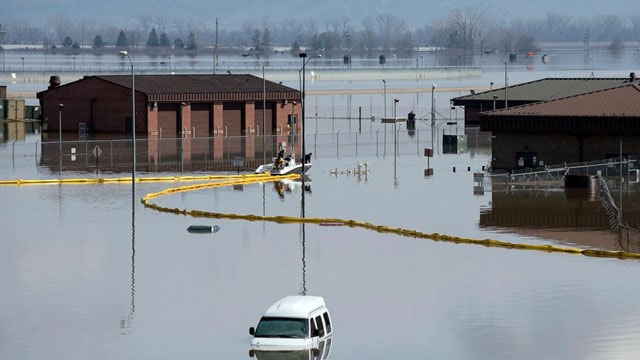
The flooding also caused significant damage in Washington state, USA. (Photo: ABCNews).
Thousands of residents have been forced to evacuate, while others are stranded on roads cut off by floodwaters and landslides, with some towns completely losing power. Mudslides and debris have severely damaged major highways. British Columbia Premier John Horgan declared a state of emergency on November 17 and deployed military forces to rescue those trapped.
Port of Vancouver, the largest port in Canada, was forced to suspend all rail services, disrupting an already strained global supply chain. The city itself was completely cut off from the rest of Canada. At least one person has been confirmed dead, and numerous others remain missing.
In Abbotsford, a town of 160,000 located east of Vancouver, many farmers ignored evacuation orders and desperately tried to save livestock from rising waters, using ropes to pull cows to higher ground.
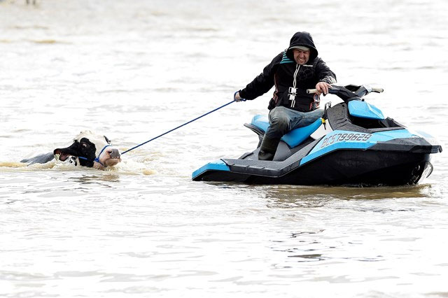
Desperate residents attempt to rescue livestock from the rising waters in Abbotsford, Canada. (Photo: Otago Daily Times).
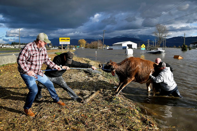
Desperate residents attempt to rescue livestock from the rising waters in Abbotsford, Canada. (Photo: CBC).
Why is the Flooding So Severe?
This area has been subjected to unusually heavy rainfall since September, with one meteorologist referring to it as a “parade of storms.” Rainfall levels in Bellingham, Washington, exceeded normal amounts throughout November.
This historic flooding is the result of a combination of heavy rainfall and an “atmospheric river.” An “atmospheric river” is known as a dense band of moisture-laden clouds, comparable in width and length to a large river in the sky, carrying more water vapor than typical clouds. This amount of moisture is sufficient to flood many cities for an extended period.
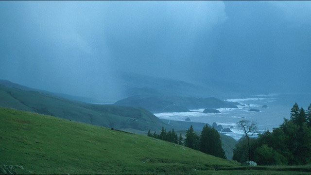
An “atmospheric river” is a dense band of clouds resembling a large river across the sky. (Photo: NOAA).
Storm scientist Jeff Masters described this phenomenon as “a river in the sky, a pipe transporting large amounts of moisture out of the tropics.”
The flooding situation was exacerbated by rampant logging, which affected slope stability, the rate of water absorption into the ground, and the soil-holding capacity of root systems. Without trees, heavy rain can wash away significant amounts of sediment into nearby water systems, clogging streams and creeks and causing them to overflow into residential areas.
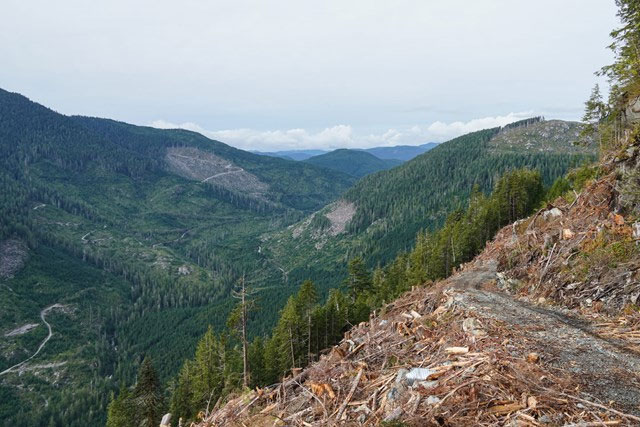
Rampant logging in British Columbia has worsened the flooding situation. (Photo: The Narwhal).
The risk of landslides also increases due to summer wildfires in the area. “There is a very clear link between a wildfire occurring and the risk of landslides,” warned forest ranger Thomas Martin. “When you burn a lot of trees, grass, and shrubs, there are fewer living organisms to hold back the water. It will flow directly and rapidly down the mountain. Furthermore, fires can dry out the soil, making it less absorbent, so the amount of runoff will be even greater.”
What Happened in This Area Last Summer?
The storms are hitting the same area that just five months ago experienced an extremely severe heatwave, causing devastating wildfires in large forests. In June, the small mountain town of Lytton recorded a temperature of 49.6 degrees Celsius, breaking Canada’s national heat record.
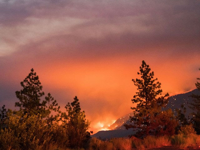
Repeated wildfires in Canada have burned down the protective barriers for residential areas. (Photo: NPR).
Many police stations and hospitals reported a surge in deaths due to the extreme heat, totaling 486 in British Columbia and dozens more south of the border. Most of these victims were elderly, with heatstroke being the primary cause of death.
The extreme heat was a result of an “heat dome” that settled over the Pacific Northwest. Although not an official term, a “heat dome” refers to a weather phenomenon created when high pressure in the atmosphere acts like a lid, trapping hot air underneath. Combined with the naturally high summer temperatures, this caused the hot air to sink to the surface, resulting in extreme heat levels.
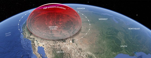
The “heat dome” prevents hot air from escaping into the atmosphere, causing record temperatures in the Pacific Northwest. (Photo: USA Today).
The Connection to the Climate Crisis
Scientists analyzing the heatwave in the region found that human-induced climate change has increased the likelihood of extreme weather events by at least 150 times. Referring to both the heatwave and the storms, Joe Boomgard-Zagrodnik, an agricultural meteorologist at Washington State University, told NBC: “The weather is typically very hot and dry in the summer, and this switch has been flipped. It certainly aligns more with what climate models are showing for the future of this region – hotter, drier summers and wetter winters.”
Humans are the primary drivers of the climate crisis on Earth. (Photo: ABC News).
As the climate warms, scientists predict that “atmospheric rivers” will form more frequently and quickly, becoming more intense, longer, wetter, and wider. According to Environment Canada, there have been five atmospheric rivers this season, a very unusual sign.
The way summer wildfires exacerbate winter flooding is a prime example of a mixed climate disaster.


