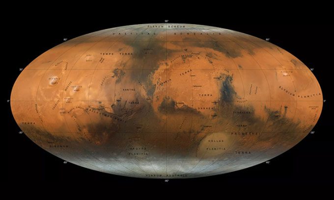
New map data from the Hope spacecraft reveals stunning geological features on the surface of Mars in three dimensions.
The high-resolution map, created by New York University Abu Dhabi (NYUAD) and the UAE National Space Science Center, could help scientists answer some pressing questions about Mars, such as how it became the arid land it is today despite having abundant liquid water in the past.

New map of Mars synthesized from observations by the Hope spacecraft. (Photo: NYUAD)
The Hope spacecraft – orbiting Mars in an elliptical trajectory – is equipped with the modern EXI imaging system, providing unique views of the Red Planet. Its observational capabilities are a testament to the growing influence of the UAE in the field of space science.
“We intend to provide a map that displays the entire surface of Mars, which will be available in both English and Arabic upon publication,” said research team leader Dimitra Atri from NYUAD in a statement. “We hope that this accessibility will make it a great tool for scientists and students alike to learn more about Mars and showcase the capabilities that the UAE’s space sector can offer.”
To create the map, Atri and colleagues collected over 3,000 observations from EXI conducted over a year on Mars, a period equivalent to two Earth years, and then stitched them together to produce a color composite.
The map has displayed many significant geological features of the Red Planet at high resolution, including icy caps at both poles, ancient mountains and volcanoes, as well as remnants of rivers, lakes, and ancient valleys that existed about 3.5 billion years ago. This has provided scientists with a better understanding of how Mars’ climate has changed over billions of years to become the barren world we see today.
“The complete Mars map will take the UAE a step closer to achieving its ambitious goal of providing a comprehensive picture of Martian climate,” Atri added. “More than 30 previous spacecraft only captured images of Martian weather, while Hope can track seasonal changes over an entire year on the planet.”
By allowing scientists to study the distribution of impact craters on the surface, the new map also reveals the history of asteroids that bombarded Mars during its early years. Thus, synthesizing EXI images could help us gain a better understanding of the conditions in the Solar System during its chaotic early period, when impacts from cosmic debris were far more common than today.
The Hope orbiter is the UAE’s first interplanetary mission and the first for the Arab world as a whole. It was launched from Japan on July 20, 2020, and after a journey of about seven months, the spacecraft entered orbit around Mars on February 9, 2021.


