It turns out that some hospitals in Turkey were able to withstand the 7.8 magnitude earthquake thanks to this special technology.
It is the Earthquake Protection Systems (EPS), a seismic isolation system developed by an American company, installed beneath major structures. Its function is to absorb shocks, allowing buildings to remain stable during earthquakes.
The EPS company, located on Mare Island, California, has been manufacturing large bearings known as seismic isolators to mitigate damage during earthquakes. Essentially, massive structures such as buildings, bridges, and factories are placed on these sliding plates to help absorb the shocks from major earthquakes.
According to Mr. Victor Zayas, the founder of EPS, the company has distributed its seismic isolators worldwide since 1987 and has installed thousands in Turkey.

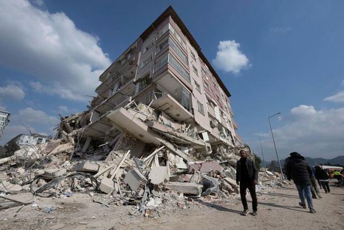
The 7.8 magnitude earthquake destroyed many buildings in Turkey. (Photo: Getty Images).
Specifically, these systems were installed at a major hospital in Adana, Turkey, which remained fully operational after two strong earthquakes measuring 7.8 and 7.5 that struck on February 6 near the Turkey-Syria border. As of the morning of February 14, according to Reuters, the earthquake disaster had resulted in over 37,000 fatalities and destroyed thousands of buildings in both countries.
Mr. Zayas stated: “The entire region has been devastated. Our hospital is the largest in the area.”
After the earthquake disaster earlier last week, many buildings in the area were damaged, except for those equipped with seismic isolation systems. EPS reports indicate that at least 9 hospitals in the region without seismic isolation systems collapsed, while over 30 hospitals that remained standing could not operate.

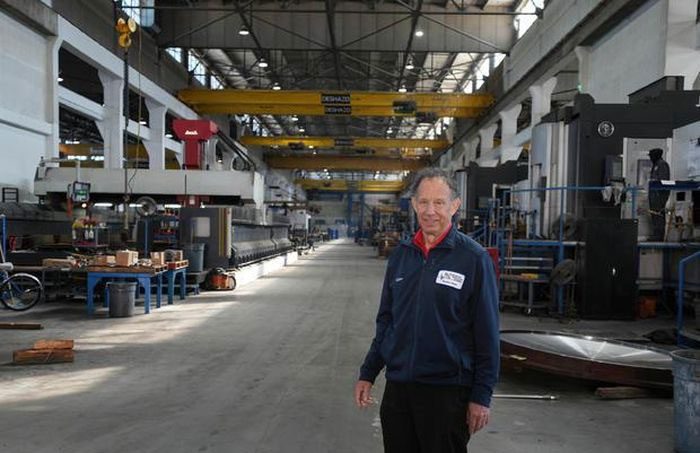
Mr. Victor Zayas, founder of EPS. (Photo: Ray Saint Germain/Bay City News).
The goal of EPS and its founder Zayas is not only to ensure buildings can withstand earthquakes but also to keep them operational, especially essential structures like hospitals.
In fact, buildings protected by EPS in Turkey are at least 12 stories tall. Mr. Zayas noted that hospitals equipped with EPS can immediately care for over 3,000 patients following an earthquake disaster.
Over the years, these special systems have helped protect at least 18 structures worldwide from earthquakes, spanning from South America to New Zealand.
EPS’s facility on Mare Island features earthquake simulation equipment used to test Zayas’s products. The first tests of Zayas’s products in Turkey took place in 2020 when the city of Elazig, which housed three hospitals equipped with seismic isolation systems, experienced a 6.7 magnitude earthquake. Notably, while 87 high-rise buildings collapsed, these hospitals remained standing and operational.
Navigation Technology Assists Rescue Teams After Earthquake Disasters
The two consecutive earthquakes in Turkey and Syria not only resulted in thousands of fatalities but also disrupted the country’s transportation network and destroyed many buildings and roads. This rendered certain routes impassable, complicating rescue efforts.
However, rescue workers now have technical tools to find new routes through the debris.
The first tool is the drone. Drones can immediately provide ground personnel with aerial images of the earthquake-affected areas, helping rescue teams determine the best or easiest routes to navigate obstacles. Additionally, drones can inform them of pathways that are impassable.
Furthermore, images captured by drones can help rescue teams identify areas that have not been searched or even detect signs of life within the rubble.
On the other hand, drones can be deployed to assess the structural integrity of buildings, assisting rescue teams in determining whether it is safe to continue their work.

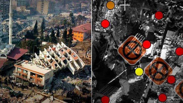
Satellites help rescue teams quickly find safe routes to save victims after the earthquake. (Photo: WSJ)
The second tool is the Copernicus satellites. The Copernicus program is considered the eyes of the European Union (EU) on Earth, monitoring factors such as floods, lava flows, wildfires, and earthquakes. In addition to individual sensors, this satellite group collects high-resolution images from companies like Airbus, Maxar, and Planet Labs, then combines them with data for mapping new areas in less than two days.
Specifically, just hours after the earthquakes struck Turkey and Syria, the Red Cross activated the EU’s Emergency Mapping Service, and Copernicus began analyzing satellite images of the affected regions. Through a combination of algorithms and human analysis, the satellite team identified destroyed roads and collapsed buildings. This information is regularly updated, providing rescue teams with new maps of the surrounding environment.


