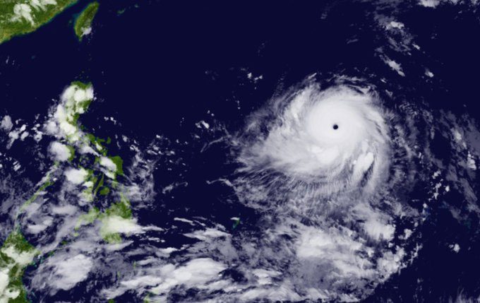
According to the Joint Typhoon Warning Center (JTWC – USA) on May 26, after strengthening to Category 5 in the Atlantic, Mawar has become the strongest storm globally so far this year.
While moving towards the Philippines, Mawar caused winds gusting up to 280 km/h. In the latest update, the Philippine Atmospheric, Geophysical and Astronomical Services Administration (PAGASA) reported that the storm has intensified as it moves westward across the Philippine Sea after becoming a super typhoon.
Weather experts also confirmed to The Independent that the strength of Mawar has surpassed any storm recorded in 2022.

Typhoon Mawar has strengthened to Category 5 in the Atlantic while moving towards the Philippines. (Photo: Twitter)
Previously, on May 24, Mawar weakened briefly while passing over Guam, USA, causing heavy rain and strong winds that uprooted trees and damaged roofs, with vehicles being blown away.
The Guam Power Authority reported that nearly the entire island, comprising 52,000 homes and businesses, experienced power outages. While there were no reports of fatalities, Mawar caused significant material damage.
According to CNN, Governor Lou Leon Guerrero stated that most of Guam has been damaged, with many local residents lacking electricity or access to clean water.
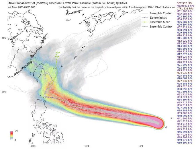
Forecasts indicate that the likelihood of Mawar making landfall in China is increasing.
Researcher at the China Meteorological Administration (CMA) Jim Yang tweeted that if Mawar makes landfall in Fujian Province, it will be the first storm in history to hit this area in May.
Additionally, if Mawar strikes Taiwan, it would also mark the first storm to impact Taiwan in May in 33 years. Researcher Jim Yang further noted that Mawar is expected to maintain its strength for 2-3 days.

Super Typhoon Mawar may make landfall in China. (Photo: Twitter).


