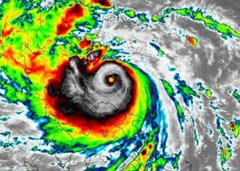
Last night, Typhoon Conson weakened into a tropical depression and has barely moved. It is forecasted that this morning, the storm will make landfall, continuing to cause strong winds in the provinces from Thừa Thiên Huế to Quảng Ngãi. Heavy rain is expected to spread to Thanh Hóa and Quảng Bình.
According to Mr. Hoàng Phúc Lâm, Deputy Director of the National Center for Hydro-Meteorological Forecasting, a notable point about Typhoon No. 5 is its very slow movement speed, only about 5 km/h. For instance, last night and early this morning, the tropical depression weakened from the typhoon and hardly moved.
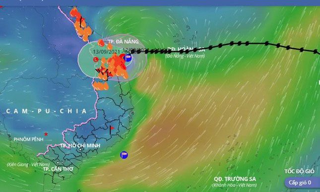
At 4 AM this morning, the center of the tropical depression that weakened from Typhoon Conson remained over the waters from Đà Nẵng to Bình Định. The strongest winds near the center of the tropical depression reached level 7 (50-60 km/h), with gusts up to level 9. The radius of strong winds of level 6 and gusts of level 8 or higher is about 80 km from the center of the tropical depression.

The tropical depression weakened from Typhoon Conson making landfall in provinces from Đà Nẵng to Bình Định this morning, continuing to cause heavy rain and strong gusts.
Due to its very slow movement speed, even though Typhoon Conson weakened quickly before making landfall, it remains very dangerous because the duration of the storm’s impact on land is quite long. Since the night of September 10, Typhoon Conson has caused heavy rain in the provinces from Quảng Trị to Quảng Ngãi, continuing until the end of today. Meanwhile, strong gusts have been reported on land since noon yesterday and are forecasted to persist until noon today.
In the next 12 hours, the tropical depression is expected to move westward, traveling about 5 km per hour, making landfall in the area from Đà Nẵng to Bình Định, and then weakening into a low-pressure area over southern Laos. The maximum wind speed at the center of the low-pressure area will decrease to below level 6 (below 40 km/h).
Due to the impact of Typhoon Conson, the waters from Thừa Thiên Huế to Quảng Ngãi (including the islands of Lý Sơn, Cồn Cỏ, and Cù Lao Chàm) will experience strong winds of levels 6-7, gusts up to level 9, and waves of 2-4 meters, with strong sea conditions.
On land this morning (September 12), the coastal areas from Thừa Thiên Huế to Quảng Ngãi are experiencing strong winds of levels 6-7, with gusts up to level 9, while further inland in these provinces, gusts of level 7 are reported.
Also due to the impact of Typhoon Conson, today (September 12), the provinces from Quảng Trị to Quảng Ngãi will see heavy to very heavy rain, with common rainfall amounts of 100-150 mm, and localized areas exceeding 200 mm. The provinces of Bình Định, Gia Lai, and Kon Tum will experience moderate to heavy rain with common rainfall amounts of 40-100 mm, and some areas exceeding 150 mm.
Today, the rain will also extend to the provinces from Quảng Bình to Thanh Hóa, lasting until September 14, with moderate to heavy rain, and in some places, very heavy rain. The total rainfall is expected to be 50-150 mm per event, with some areas exceeding 150 mm per event.

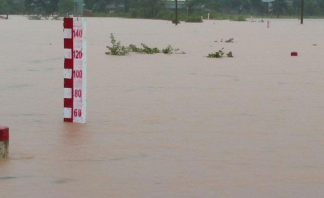
Flooding in Kon Tum due to heavy rain.
According to Mr. Phùng Tiến Dũng, Head of the Central, Central Highlands, and Southern Hydro-Meteorological Forecasting Department of the National Center for Hydro-Meteorological Forecasting, due to the prolonged heavy rain caused by the circulation of Typhoon Conson, rivers and streams in the provinces from Quảng Bình to Quảng Ngãi and Kon Tum will see a rise in water levels.
In particular, the flooding will mainly concentrate in the provinces from Thừa Thiên Huế to Quảng Ngãi and Kon Tum. Flood levels on rivers are expected to reach alert levels 1 to 2 and above level 2. Flood levels on rivers in Quảng Bình and Quảng Trị will be lower, around alert level 1 and above level 1. However, some smaller rivers and streams may experience localized severe flooding.
Mr. Dũng stated that although the peak flood levels of major rivers are not expected to be too high, the rapid succession of heavy rains poses a very high risk of flash floods and landslides in mountainous areas of the provinces from Thừa Thiên Huế to Quảng Ngãi and Kon Tum. Additionally, due to the heavy rain, localized flooding in the low-lying areas of the provinces from Thừa Thiên Huế to Quảng Ngãi is widespread, and residents need to take precautions.
The risk of localized flooding may occur in 40 districts in Central Vietnam. Specifically, in Hà Tĩnh, it includes Hà Tĩnh City, Kỳ Anh Town, and Cẩm Xuyên. In Quảng Bình, it includes Tuyên Hóa, Minh Hóa, Lệ Thủy, Quảng Ninh, Quảng Trạch, Bố Trạch, Đồng Hới City, and Ba Đồn Town. In Quảng Trị, it includes Hướng Hóa, Đắk Rông, Gio Linh, Triệu Phong, Hải Lăng, Cam Lộ, Đông Hà City, and Quảng Trị Town.
Thừa Thiên Huế includes A Lưới, Phong Điền, Nam Đông, Phú Vang, Huế City, Phú Lộc, and Quảng Điền. Đà Nẵng includes Đà Nẵng City, Liên Chiểu, and Hòa Vang. Quảng Nam includes Tam Kỳ City, Đại Lộc, Duy Xuyên, Điện Bàn, and Hội An. Quảng Ngãi includes Bình Sơn, Mộ Đức, Tư Nghĩa, and Quảng Ngãi City.
The risk of landslides is high in the districts of Hương Thủy, A Lưới, Nam Đông, Phong Điền, and Hương Trà in Thừa Thiên Huế. In Quảng Nam, it includes Nam Giang, Tây Giang, Phước Sơn (Phước Hòa, Phước Thành, Phước Công, Phước Kim), Nam Trà My (Trà Vân), Bắc Trà My (Trà Bùi, Trà Nú), Quế Sơn, Tiên Phước, and Đại Lộc (Đại Hồng). In Quảng Ngãi, it includes Trà Bồng, Tây Trà Sơn Tây, Sơn Hà, Ba Tơ, and Minh Long. In Quảng Trị, it includes Hướng Hóa and Đăk Rông.


