One of the main reasons for the record-breaking global temperatures in 2023—El Niño—has faded, and in contrast, La Niña is about to emerge.
The National Oceanic and Atmospheric Administration (NOAA) reported a 55% chance of La Niña developing from June to August and a 77% chance from September to November in 2024.
Sudden Cold Phase Transition: A Sign of a Severe Hurricane Season?
This year, weather forecasters anticipate a rapid transition to La Niña. Following a super El Niño from 2023 to 2024, the ocean is showing conditions conducive to a quick shift to the cold phase (La Niña). How long La Niña will last in 2024 remains an open question.
“This cycle typically oscillates from extreme to moderate extremes every 3 to 7 years, but while El Niño tends to last for shorter durations (like the 2023-2024 El Niño), La Niña can persist for 2 years or more,” said Pedro DiNezio, a scientist at the University of Colorado.
CNN quoted meteorological experts stating that La Niña produces weather patterns opposite to El Niño. The quicker transition to La Niña could have a greater impact on the upcoming hurricane season, which starts in June and typically peaks in September each year.
So, what is the global impact of La Niña?
La Niña and the 2024 Pacific Hurricane Season
The 2024 Pacific hurricane season is approaching rapidly, with the official start date set for May 15 in the eastern Pacific and June 1 in the central Pacific.
As of early May 2024, no tropical storms have developed in the Pacific this year.
A key factor to consider for the 2024 hurricane season is the ongoing transition from El Niño to La Niña, which will significantly affect the number of tropical cyclones developing in the eastern and northwestern Pacific over the next six months.
The potential development of La Niña at the peak of the 2024 Pacific hurricane season could greatly influence the number of tropical storms. According to typical La Niña patterns, the development of tropical storms is also hindered in the central Pacific and much of the western Pacific, except for the South China Sea.
Explaining this, a meteorologist from Vietnam’s National Center for Meteorology and Hydrology stated: The atmospheric conditions during the transition from El Niño to La Niña, combined with climate change, will continue to contribute to increased extremes. Therefore, the second half of 2024 will experience complex disaster developments, including heat waves, droughts, and thunderstorms with hail more severe than normal.
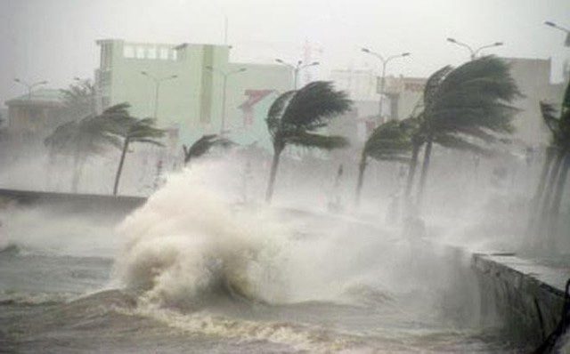
This expert further noted that from now until the end of the year, the South China Sea will see around 11-13 storms, of which 5-7 will impact land.

The South China Sea will experience around 11-13 storms by the end of the year. (Illustration).
The National Center for Meteorological Forecasting predicts that from July to December 2024, the number of storms and tropical depressions (TD) in the South China Sea, as well as their impact on land, is expected to be near the long-term average, with a likelihood of concentration during the second half of the rainy season.
From July to September 2024, storms and TDs will affect the northern provinces, while from September to December 2024, they will impact the central provinces and the southern region.
The center warns that in the latter half of 2024, strong winds and high waves at sea due to the influence of storms/TDs and the southwest monsoon in the central and southern South China Sea, along with cold air from November to December 2024 in the region, may affect activities at sea.
Additionally, phenomena such as thunderstorms, whirlwinds, lightning, and hail will negatively impact agricultural production and livelihoods in affected areas.
La Niña Makes the Atlantic Hurricane Season More Severe
Temperatures in the tropical Pacific also control wind shear across much of the Atlantic.
Wind shear is the difference in wind speed at various altitudes or directions. Storms struggle to maintain their vertical structure when encountering strong wind shear.
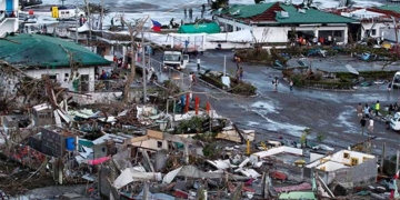
In contrast, La Niña creates less wind shear, reducing the ability to inhibit storms. This is not good news for those living in hurricane-prone areas like Florida, USA. During the La Niña event from 2020 to 2021, the Atlantic witnessed a record 30 tropical storms and 14 hurricanes, while 2021 saw 21 tropical storms and 7 hurricanes.
Forecasters have warned that the 2024 Atlantic hurricane season could be on par with 2021, largely due to La Niña.
The tropical Atlantic is also unusually warm, with sea surface temperatures setting records for over a year. This warmth affects the atmosphere, causing increased atmospheric activity over the Atlantic and leading to storm formation.
La Niña’s Global Impact in the Southern Hemisphere
The effects of El Niño and La Niña are nearly mirrored in the Southern Hemisphere, meaning this region bears the brunt of these phenomena.
Chile and Argentina tend to experience more frequent droughts during La Niña, while the Amazon sees increased rainfall.
Australia endured severe flooding during the La Niña event from 2020 to 2021.
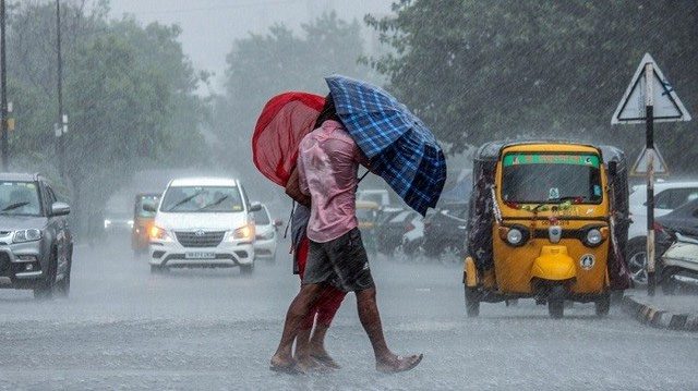
La Niña also facilitates the Indian monsoon, resulting in above-average rainfall. However, these effects do not occur immediately. For example, in South Asia, changes tend to manifest a few months after La Niña officially appears.

The potential development of La Niña at the peak of the 2024 Pacific hurricane season. (Illustration).
In Eastern Africa, La Niña has a particularly adverse impact, where vulnerable communities are suffering from prolonged drought.
Does Climate Change Affect La Niña’s Impact?
El Niño and La Niña are currently occurring due to the effects of global warming, which can exacerbate temperatures, as seen in 2023, and may lead to above-normal rainfall.
Since the summer of 2023, the world has experienced 10 consecutive months of record-breaking global temperatures. Much of the warmth comes from the oceans, which remain at record high temperatures.
While La Niña can cool things down slightly, greenhouse gas emissions causing global warming continue to rise. Therefore, while fluctuations between El Niño and La Niña may lead to short-term temperature changes, the overall trend is that the world is still warming.


