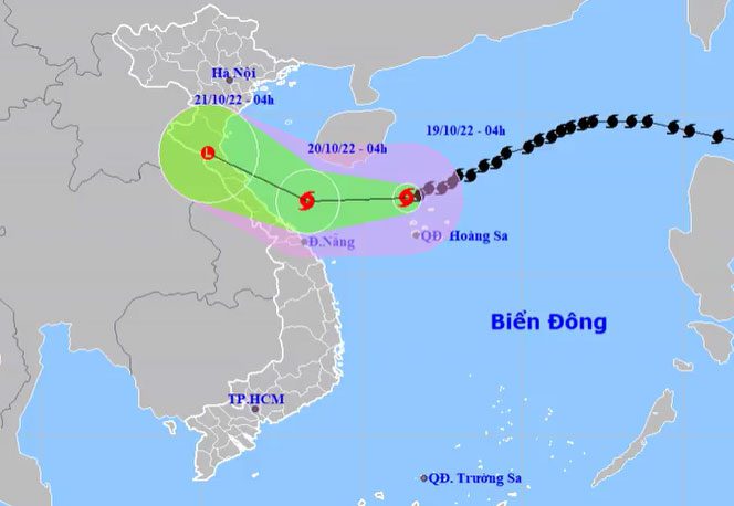
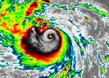
At 4 AM this morning, the eye of the storm was located over the northern waters of the Paracel Islands, with maximum wind speeds of 117 km/h, classified as level 10-11, a decrease of one level compared to yesterday afternoon.
The National Center for Hydro-Meteorological Forecasting reported that today the storm is moving in a west-southwest direction at a speed of 10-15 km/h. By 4 AM on October 19, the storm’s center is approximately 120 km away from Quang Binh and Thua Thien Hue, and due to interaction with a strong cold air mass, wind speeds have decreased to 74 km/h, classified as level 8, with gusts increasing by two levels.
The storm then changed direction, veering northward and continuing to weaken into a tropical depression. By 4 AM tomorrow, the center of the tropical depression will be over the provinces from Thanh Hoa to Quang Binh, with maximum wind speeds of over level 6, around 50 km/h.

Projected path and impact area of the storm. (Photo: NCHMF)
The Japan Meteorological Agency forecasts that tonight the storm will weaken into a tropical depression before making landfall in the provinces of Ha Tinh and Quang Binh. The Hong Kong Observatory has similar assessments regarding the storm’s path and intensity.
Due to the storm’s influence, in the next 24-48 hours, the northern East Sea (including the waters of the Paracel Islands) will experience stormy weather, with strong winds ranging from level 8 to level 11. In the middle of the East Sea, the Gulf of Tonkin, and the waters from Quang Tri to Quang Ngai (including the islands of Con Co and Ly Son), strong winds of levels 6-7 are expected.
In the northern East Sea, waves will reach heights of 4-6 meters, with heights near the storm center reaching 6-8 meters. In the middle of the East Sea, wave heights will be 4-6 meters. In the Gulf of Tonkin and the waters from Quang Tri to Quang Ngai, wave heights will be 3-5 meters.
Over the past 20 days, the East Sea has experienced three storms, including Noru, Son Ca, and Nesat. Most recently, Storm Son Ca weakened into a tropical depression, making landfall in Da Nang – Quang Nam in the early hours of October 15, causing rainfall from Quang Tri to Quang Ngai, with the heaviest rainfall in Da Nang and Thua Thien Hue. Da Nang has faced unprecedented flooding, resulting in 6 fatalities, with significant damage to transportation infrastructure and residents’ property, the extent of which is yet to be assessed.
Long-term forecasts indicate that from now until January 2023, the East Sea may see around 3-5 storms and tropical depressions, with 2-3 of them potentially having a direct impact on Vietnam, particularly focused on the Central and Southern regions.


