In the images recently released by the Russian Space Agency (Roscosmos), the power of the earthquake disaster, estimated to be equivalent to 500 nuclear bombs, is horrifyingly illustrated through tectonic fractures.
Tectonic plates can be understood as the Earth’s crustal segments that “carry” continents and oceans. These plates move over geological time but are rarely noticeable within a single generation. However, seismic activity and volcanic eruptions are more likely to occur at the boundaries of tectonic plates, such as in Turkey.
The images captured by the Kanopus-B spacecraft from Roscosmos, as reported by Sputnik, show the tectonic fractures through images of the Southeastern region of Turkey before and after the disaster.
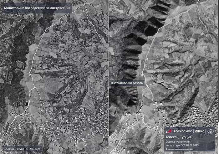
Tectonic fractures viewed from the Kanopus-B spacecraft, with the left image taken before the disaster and the right image taken after – (Image: ROSCOSMOS).
Meanwhile, images from NASA, JAXA (Japan Aerospace Exploration Agency), and the Singapore Remote Sensing Laboratory are filled with red and orange dots indicating the devastation in the cities of Turkoglu, Kahramanmaras, and Nurdagi (Turkey).
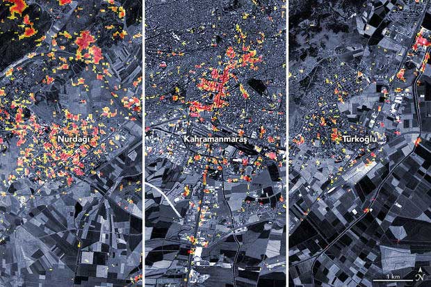
Each red, orange, and yellow pixel represents areas of 30m x 30m that were completely devastated, severely damaged, or lightly damaged – (Image: NASA/JAXA/Singapore Remote Sensing Laboratory).
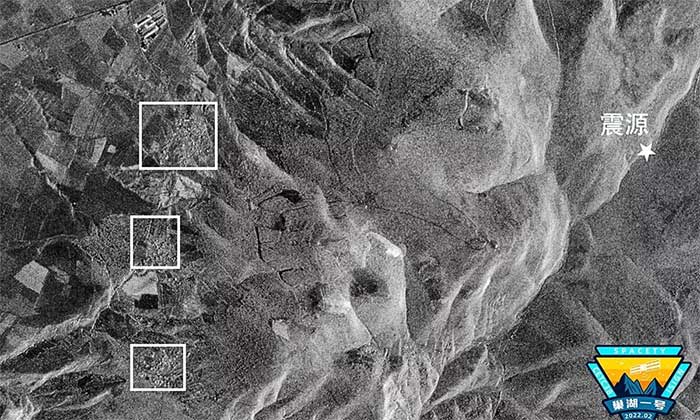
The Chauhu-1 satellite from China also shows the heavily damaged area around the epicenter.
Other shocking images include:
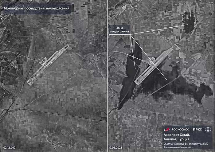
Hatay Airport severely flooded – (Image: ROSCOSMOS).
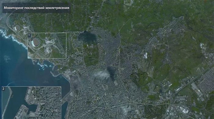
The Latakia region of Syria also devastated – (Image: ROSCOSMOS).
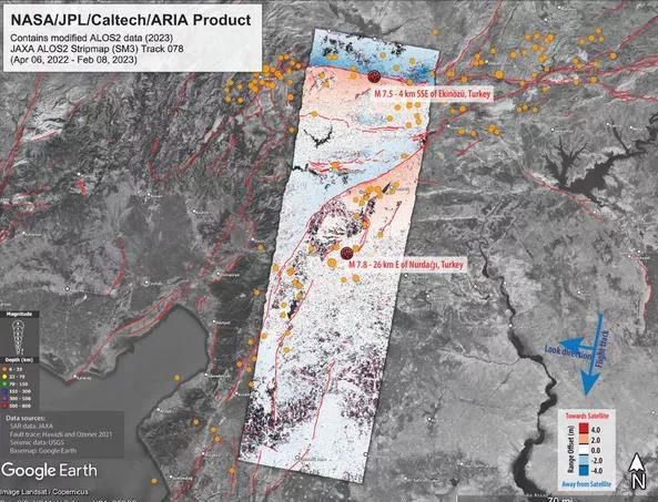
Surface displacement map showing the direction of ground movement (red) and sliding away (blue arrow) – (Image: NASA/JAXA).
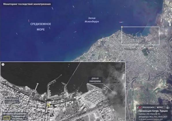
Another Russian satellite, Kanopus-V, captured Hatay province before and after the earthquake, showing many shattered areas – (Image: ROSCOSMOS)
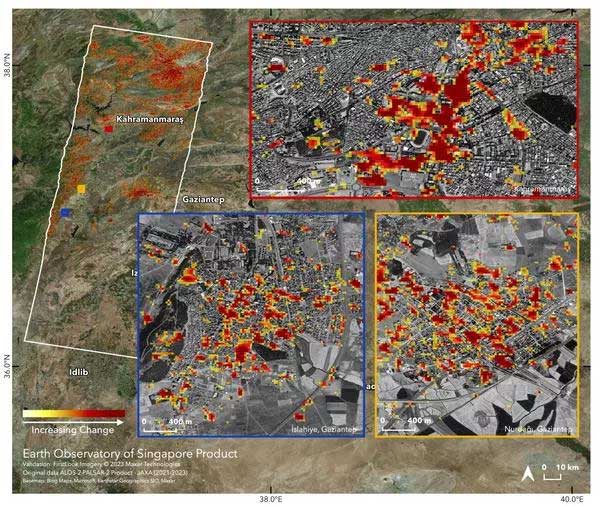
Another damage map in Turkoglu, Kahramanmaras, and Nurdagi – (Image: JAXA/Singapore Remote Sensing Laboratory).
According to Sputnik, the double earthquake disaster that struck Turkey and Syria on February 6 was the strongest to hit the region since 1939, causing widespread devastation, flooding at the major Hatay airport, and even shifting the tectonic plates of the Earth. Scientists estimate the deadly power of the disaster to be equivalent to 500 nuclear bombs.


