Hurricane season typically occurs each year in tropical regions, from mid-June to December, when the Intertropical Convergence Zone operates at a distance of 5-200 degrees from the equator in both hemispheres.
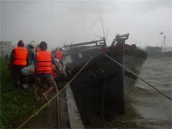 |
Rescue forces are working hard to save ships battered by waves in the eastern Han River. |
On average, there are about 70 storms and tropical depressions (minor storms) worldwide each year, with 15% of the global population directly affected by storms, leading to property damage amounting to billions of USD.
Storms are a natural phenomenon categorized into five levels based on wind strength. Level 1 has maximum winds of 50 km/h, while the most intense (Level 5) can have winds of 250-300 km/h.
In our country, which is tropical, there are typically around 10 significant storms annually, with maximum winds reaching 80-100 km/h. However, there have also been storms that reached 120-130 km/h, and in some exceptional cases, even exceeded 130 km/h, such as the 1904 storm (Year of the Dragon), Typhoon No. 8 (Cecil) on October 16, 1985, which caused extensive damage in Hue, and Typhoon No. 5 (Linda) in 1997, which struck the coastal provinces of Southern Vietnam from Vung Tau to Con Dao and Ca Mau Cape, causing the most significant damage in the past 100 years. From June to September, storms typically affect the northern provinces, while from September to the end of the year, they impact the southern provinces (from Thua Thien – Hue southward).
The movement of storms is a crucial issue for meteorologists, as it is entirely dependent on surrounding weather systems, which are constantly changing. As science and technology advance, it is now possible to see the potential formation of a storm from the moment it begins as a convective cloud; however, accurately predicting its movement remains a challenging problem.
Even with the recent Damrey storm (No. 7), which simultaneously passed over Hainan Island, Guangdong (China), and Vietnam, reports from China indicated wind speeds of nearly 200 km/h, the strongest in over 30 years, causing damages up to 1.2 billion USD. In contrast, reports in our country only indicated wind levels from Category 9 to over Category 12 along the storm’s path.
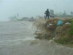 |
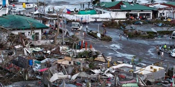
The Son Tra – Dien Ngoc coastal route has been severely eroded due to high tides (photo taken on November 1). |
For a storm to form, two conditions must be met: first, the temperature must be above 27°C, and second, there must be moisture present. Initially, warm air absorbs moisture and rises due to solar heat. Water vapor condenses into rain, releasing heat that causes the humid air to expand and rise higher, drawing in more moisture from below. This creates a spiraling area of rising warm air.
A storm is essentially a colossal vortex of wind with a diameter of tens or hundreds of kilometers, reaching heights of up to 20 km.
An average storm carries more energy than an atomic bomb detonating every minute. What can we do to mitigate the destructive power of storms when we cannot control their energy? The best we can hope to do is to monitor storms.
Currently, artificial satellites perform this task very efficiently, providing timely alerts about storms so we can evacuate and find safe shelter. However, we cannot stop or fight against storms; we can only predict and take preventive measures to minimize damage.
Since storms require moisture, most storms tend to weaken when they make landfall and dissipate within a few days. In the future, if our planet experiences increased warming due to the greenhouse effect, the number of storms may significantly rise. Sea temperature is a primary factor in storm formation, and as more sea areas exceed 27°C, it means more regions will likely generate storms.
NGÔ TUỆ

