Due to adverse weather conditions, satellite systems activated to capture images of the earthquake in Turkey and Syria faced significant difficulties.
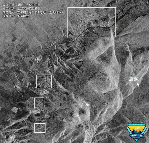
Spacety, a Chinese startup specializing in the development of small satellites, shared images around the epicenter of the powerful 7.8 magnitude earthquake that struck on February 6 in the Nurdagi district, approximately 23 km from Gaziantep Province, Turkey.

Earthquake area in Turkey captured by the Chaohu-1 satellite. (Photo: Spacety).
Immediately following the earthquake, Spacety deployed the Chaohu-1 satellite, equipped with synthetic aperture radar (SAR), to capture images. According to Global Times, the photo was taken around 11:05 AM local time on February 6.
The area observed by the satellite covers approximately 8,878 km2. At the time of the disaster, the weather at the epicenter was extremely harsh with thick clouds, complicating satellite imaging efforts.
A representative from Spacety stated that they would continue to monitor the situation in the earthquake-affected area while providing satellite imagery to assist in rescue and relief efforts.
After the initial earthquake, at least 185 aftershocks were recorded in southeastern Turkey and surrounding areas. Experts indicated that given the unpredictable situation, satellites became the primary means of providing location and data.
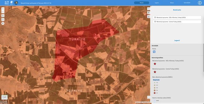
Shortly after the disaster, the United Nations Satellite Centre (UNOSAT) activated its emergency satellite mapping service. This program provides satellite imagery in humanitarian emergency situations related to natural disasters, complex scenarios, and conflicts.
Users can access maps on the UNOSAT website. According to Space, the maps provide information on earthquake-affected areas, magnitude, and damaged or potentially damaged structures.
UNOSAT was established in 2001 to provide satellite data for the United Nations. By 2003, the program expanded to satellite mapping for humanitarian situations.

Satellite map provided by UNOSAT.
The center collaborates with member states of the United Nations to collect satellite images. The data is then sent to government agencies, aid organizations, and humanitarian groups to plan rescue and relief operations.
On February 6, the European Union (EU) also activated the Copernicus satellite system to provide emergency mapping services, focusing on residential areas affected by the earthquake.
Egeos, the company responsible for the Copernicus system, stated that the satellites collected images, but the quality was quite poor due to adverse weather conditions. According to Ansa, the first images are expected to be released in the coming hours once processing is complete.
The earthquake disaster in Turkey has resulted in over 3,500 fatalities, while Syria has reported more than 1,600 deaths. The numbers are expected to rise as search and rescue operations continue.
In Turkey alone, the number of injured has surpassed 20,000. The Turkish Disaster Management Agency reported receiving 11,342 reports related to building collapses, of which 5,775 incidents have been confirmed.


