Each upgrade of the supercomputer at the National Weather Service (NWS) in the United States is the size of ten refrigerators, with a processing power of 12.1 petaflops, aimed at enhancing the ability to forecast storms.
When Hurricane Michael made landfall along the Gulf Coast in October 2018, it reached Category 5 with maximum winds of 250 km/h, making it one of the strongest storms to hit the U.S. The initial forecast from the National Hurricane Center (NHC) was completely off, predicting that Hurricane Michael would only reach half that intensity.
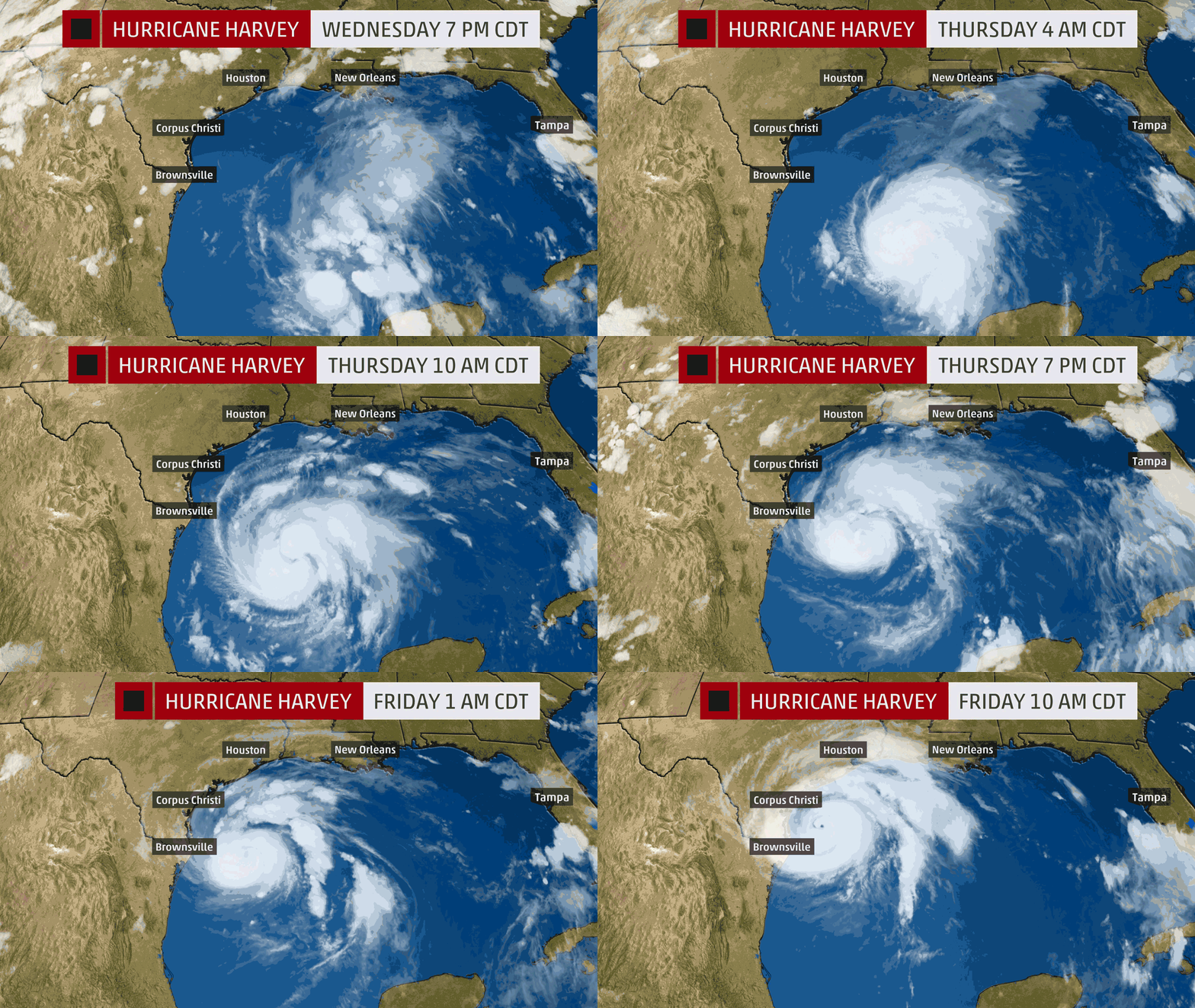
Typically, it takes a storm several days to a week to transition from a tropical storm to a major hurricane. However, if the right conditions converge, the time for it to strengthen into a Category 3/5 hurricane can be measured in hours.
Hurricane Michael rapidly intensified just before making landfall. This process is known as rapid intensification. The NHC defines rapid intensification as occurring when a storm’s winds increase by at least 55 km/h within 24 hours.
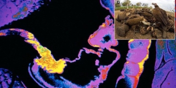
The rapid intensification process transforms tropical storms into major hurricanes. (Image: GOES-16 Experimental).
Even until landfall in Florida, experts were unaware that Hurricane Michael was undergoing rapid intensification. This was a primary reason the storm became unexpectedly strong compared to initial predictions.
Accurately predicting the level of chaos in a storm’s center, or in other words, how a storm intensifies, remains a significant challenge for forecasting experts.
The Power of Supercomputers in Weather Prediction
However, equipped with better simulation models and more experience, the NHC accurately predicted that Hurricane Ida, which made landfall in New Orleans in September 2021, would rapidly intensify, even though the storm ended up being stronger than expected.
Supercomputers are a crucial part of these advancements in predicting the location, timing, and manner in which storms may strike. By the end of 2021, the National Weather Service (NWS) continued to upgrade with two brand new supercomputers.
The NWS hopes that these valuable upgrades will help improve stability, aiming for more accurate forecasts. This has become increasingly necessary as experts believe that climate change, with global warming, is causing storms to become more dangerous.

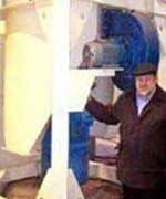
Dogwood, one of NOAA’s two newest supercomputers for weather forecasting. (Image: General Dynamics Information Technology).
The NWS will fully utilize the supercomputers’ extraordinary computational capabilities in weather forecasting, similar to the systems used in nightly reports. The new supercomputers will assist meteorologists in better predicting everything from the probability of rain in Denver to the likelihood of a storm making landfall in Miami.
Each supercomputer (one in Virginia and one in Arizona) is the size of ten refrigerators and has a processing power of 12.1 petaflops (12.1 million trillion calculations per second). FLOPS stands for floating-point operations per second, a metric used to compare processor performance across different architectures.
According to MIT Technology Review, each major upgrade of a supercomputer will nearly triple the size of the old system and cost approximately $300-500 million over the next decade.
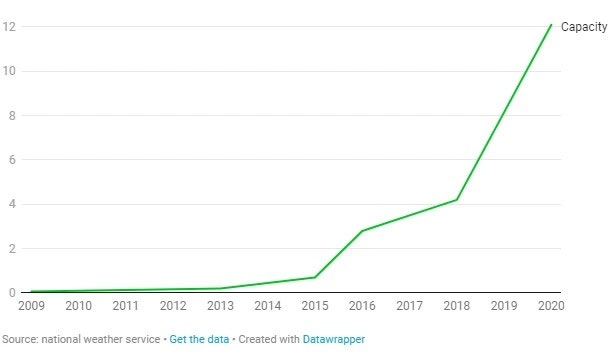
Processing power of supercomputers at the National Weather Service (NWS) over the years. Image: NWS.
Michael Brennan, head of the Hurricane Specialist Unit at the NHC, stated that upgrading supercomputers is a vital part of recent improvements in forecasting the paths and intensities of major hurricanes.
This has been proven as forecasts of storm paths have become increasingly accurate over the past 30 years, thanks to improved large-scale weather models processed on supercomputers. The average error in predicting storm paths has decreased from about 161 km in 2005 to just around 105 km in 2020.
The difference may seem small, but when a storm unexpectedly transitions into a major hurricane and accurate impact forecasts are needed, Brennan believes that “every minor fluctuation is very important.”
Understanding and predicting the intensity of storms is more challenging than forecasting their paths, as the strength of a storm can be influenced by favorable environmental factors such as wind speed and temperatures in the storm’s center.
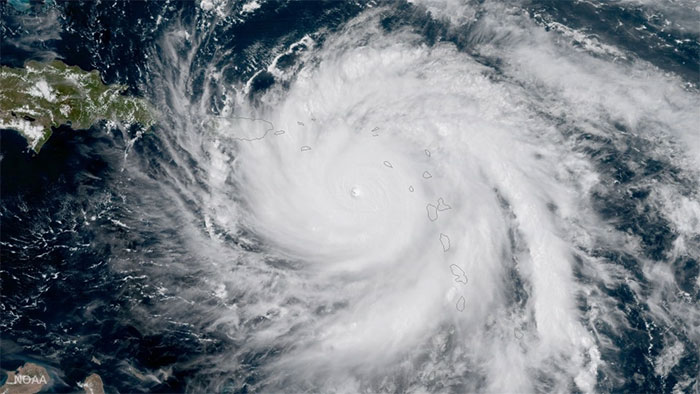
Hurricane Maria at its peak intensity. (Image: NOAA).
Nevertheless, with calculations from supercomputers, intensity forecasts have also begun to improve over the past decade. Statistics show that the error in intensity forecasts within 48 hours has decreased by 20-30% from 2005 to 2020.
“When building models to predict something as complex as the weather, it becomes easier when additional resources from computers are integrated,” said Brian Gross, director of the modeling center at NWS.
Increasing Accuracy
Predictive models can benefit from computational power in many ways, as they quickly consume large amounts of capacity. A model can become more complex by using more information, such as details about ocean currents when considering the frequency of storms.
Upgrading computational hardware allows a weather forecasting model to be more geographically accurate. Weather models work by breaking the Earth into many pieces and trying to calculate what will happen in each piece. If a model has high resolution, it will break the Earth into smaller pieces, meaning more of them are considered and predicted in various scenarios.
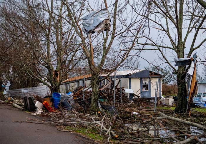
Hurricane Ida caused significant damage in Lafourche Parish, Louisiana. (Image: New York Times).
Ultimately, researchers will sift through everything into an ensemble model and will run tests a maximum of 20 or 30 times. Each run will be conducted under different weather conditions, resulting in various predictions. The results will then be compiled and reviewed carefully to determine necessary evacuation and response plans.
The ensemble model in storm prediction works as follows: When a storm begins in the Atlantic, if an ensemble forecast contains many different outcomes, with some storms heading toward Texas and others passing through the East Coast in various regions, there will be multiple hypotheses about the path.
However, if all members of the group agree that the storm is heading toward Florida, forecasters can be more confident about the potential landfall location.
Previous supercomputer upgrades have led to improvements in various fields for several models, such as the Global Ensemble Forecast System (GEFS). In 2018, during the last system upgrade, the NWS increased the resolution from 34 km to 25 km, with the maximum number of ensemble models increasing from 21 to 31.
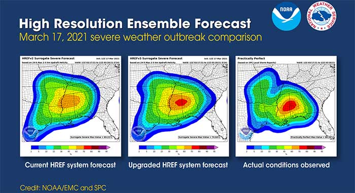
Ensemble models of weather prediction scenarios. (Image: NOAA).
These changes and accurate forecast results have helped experts like Jim Stefkovich, a meteorologist at the Alabama Emergency Management Agency, better support state governments in preparing for weather risks.
“In the early days of my career, many times things happened without warning because the technology wasn’t good enough, and warnings weren’t always accurate. However, you won’t see that as much anymore with the current technology upgrades,” Stefkovich said.
Global climate change is causing tropical storms to potentially worsen. Experts hope that with technology-supported forecasts communicated effectively, people can make better decisions when storms approach.


