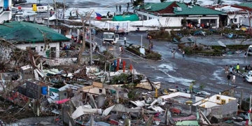
After sweeping through Luzon Island (Philippines), Super Typhoon Noru is heading out to the East Sea and “reviving” its strength before making landfall in Central Vietnam.
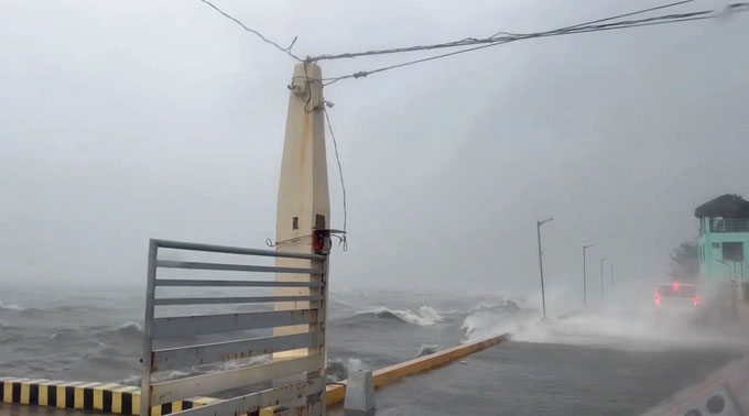
The strength of Typhoon Noru as it moved across Luzon Island, Philippines. (Photo: Noru).
Scientists indicate that human-induced climate change has rapidly increased the strength of Super Typhoon Noru.
This is the strongest storm in the East Sea so far this year. On September 25, the typhoon made landfall in the Luzon area, Philippines, with a speed of 195 km/h, causing significant damage such as landslides, heavy rain, and strong winds, forcing approximately 8,400 people in the danger zone to evacuate and resulting in the cancellation of dozens of flights.
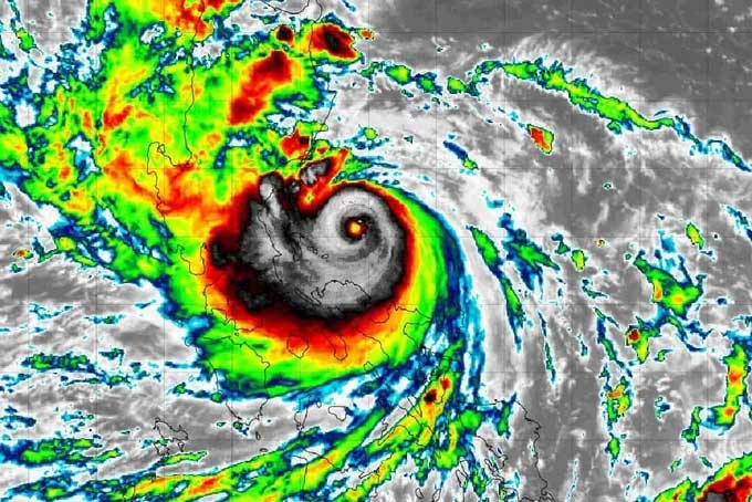
Satellite image of Super Typhoon Noru taken on September 25, showing the large tropical cyclone predicted strength of this storm (Photo: Toute la Thailande).
It is expected that after sweeping through Luzon Island, Super Typhoon Noru will head out to the East Sea and “revive” its strength before making landfall in Central Vietnam.
Scientists state that human-induced climate change is increasing the likelihood of rapid strengthening of storms.
To predict the strength of a storm or tropical depression, scientists rely on satellite imagery from tropical cyclones, characterized by a center of low pressure, strong winds, and a spiral thunderstorm cloud structure that produces heavy rain.
Depending on their location and intensity, tropical cyclones are referred to by various names such as: hurricane, tropical storm, cyclonic storm, or tropical depression…
Specifically, Typhoon Noru has experienced a rapid intensification rate of up to 90 knots within 24 hours, marking the fourth-fastest increase in intensity among recorded storms.
According to a report from the Center for Climate and Energy Solutions (C2ES) based in the U.S., long-term changes due to climate change are expected to worsen the frequency, intensity, and impacts of storms.
For instance, warmer sea surface temperatures will increase wind speeds of storms, causing more damage when they make landfall. Additionally, these storms also lead to hurricanes, with rainfall amounts from storms increasing by 10-15%.
Sea level rise is a significant factor enhancing the strength of storms; the average global sea level has risen more than half a foot since 1900 and is projected to increase by 1 to 2.5 feet this century due to climate change. This raises the risk of flooding for coastal areas during storms.
Moreover, changes in the atmosphere, such as Arctic warming or rising temperatures at mid-latitudes, can alter tropical storm patterns, leading to more storms appearing at higher latitudes.
Scientists have observed a northward shift of storms, where they reach the highest intensities recorded in the Pacific, including Typhoon Noru – one of the four storms that have rapidly intensified in history.

Boats being towed ashore; starting September 25, Hoi An City will temporarily ban sea access to prevent the impact of Super Typhoon Noru (Photo: Ngo Linh).
Due to the effects of Typhoon Noru, starting from the afternoon of September 25, the eastern sea area of the North and Central East Sea will experience gradually increasing winds of 8-9 levels, then rising to 10-11 levels, with the area near the eye of the storm reaching 12-13 levels, gusting up to 16. Sea waves will be 6-8 meters high, and near the storm’s center, waves could reach 8-10 meters, causing severe sea disturbances.
This is a very strong storm with a fast movement speed, forecasted to make landfall in the Central region, potentially causing heavy rainfall, resulting in flash floods, landslides, and mudslides.
