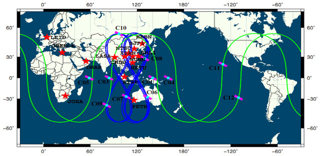
When it comes to satellite positioning systems, many people think of GPS first. However, few know that China has a more advanced and powerful positioning system than GPS, known as Beidou (BDS; BeiDou Navigation Satellite System).
Beidou is a globally developed satellite positioning system by China, capable of precise positioning and navigation. With the continuous advancements in science and technology, the Beidou satellite system plays a vital role not only in navigation and vehicle guidance but also in various fields such as military applications, disaster monitoring and rescue, agriculture, and more, providing significant convenience and safety for people’s lives.
Time Services
Beidou satellites are not only capable of navigation and positioning but also have a variety of functions, one of which is providing time services. As modern society becomes increasingly time-sensitive, the time service of Beidou satellites plays an essential role in various fields.
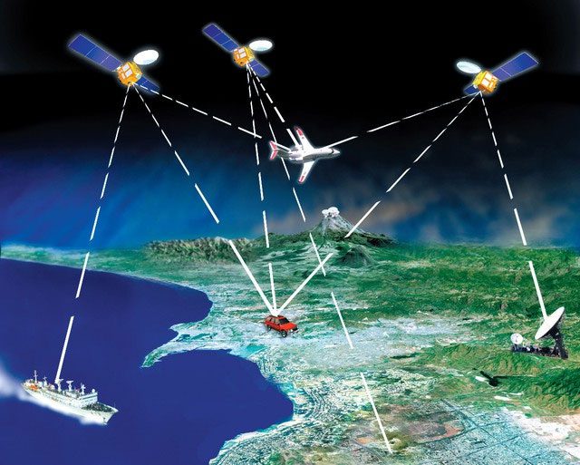
Beidou is a globally developed satellite positioning system by China.
The Beidou satellites provide users with high-precision time services through highly accurate atomic clocks and time synchronization technology. Whether in scientific research, finance, communications, power, or other industries, accurate time is essential for data recording, transaction resolution, network synchronization, equipment operation control, and other work aspects. The time service of Beidou satellites can meet these demands and ensure that the time of each system is accurate and reliable.
In the field of scientific research, time accuracy is crucial for many experiments and observations. For instance, in astronomical observations, scientists need to record precise time points of celestial movements to study the evolutionary processes and changing patterns of the universe. The time service from Beidou satellites provides high-precision time signals and offers scientists an accurate time standard, making scientific research work more precise and reliable.
The finance sector has even stricter time requirements. In financial transactions such as stock trading and foreign exchange, the accuracy of timing directly impacts the success or failure of the transaction. The time service of Beidou satellites can provide high-precision time synchronization for financial organizations to ensure the accuracy and fairness of transactions. Additionally, in financial monitoring, the accuracy of timestamps is also critical, and the time service from Beidou satellites can provide regulatory bodies with reliable time evidence, maintaining order and stability in the financial market.
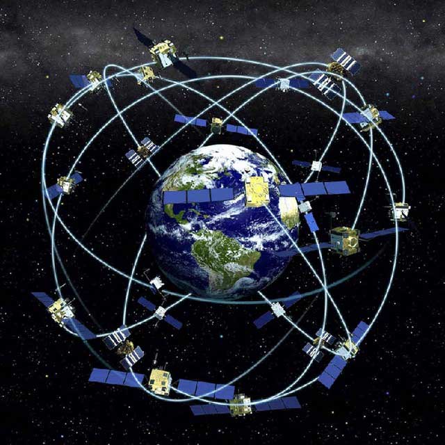
Beidou satellites provide users with high-precision time services.
The time service from Beidou satellites plays a crucial role in various fields. Through high-precision time signals, it provides accurate and reliable timestamps for scientific research, financial transactions, power transmission systems, etc., while promoting the development and operation of various sectors of society.
Communication Services
The Beidou satellite communication service offers users convenient communication methods with extensive coverage and diverse forms. Beidou satellites can transmit text information via a messaging service, which is vital for those needing to send urgent messages far from the mainland or communication networks.
For example, ships navigating at sea can communicate with families and businesses onshore through Beidou’s messaging service to ensure safety and smooth operations. Moreover, the messaging service can also be applied to various wireless communication scenarios, such as weather alerts, disaster rescue, etc., providing timely and accurate information exchange.
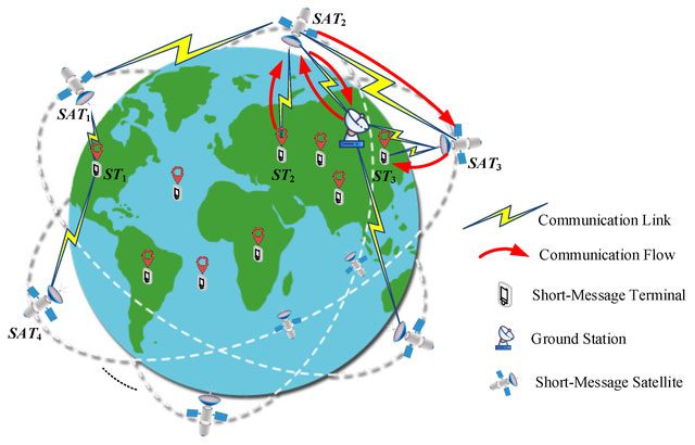
Beidou satellites provide users with convenient communication methods.
In addition to text messaging services, Beidou satellites can also facilitate small to medium data transmission through data linkage services. This data linkage service can transmit not only text information but also multimedia content such as images and audio. This provides an effective means for remote monitoring, remote sensing mapping, and other fields.
For instance, some wildlife researchers in remote areas can transmit images and sounds of wildlife to research centers via Beidou’s data linkage service to achieve remote observation and analysis capabilities. Beidou’s data linkage service can also be used in agriculture, such as monitoring agricultural land, assessing crop conditions, etc., to assist farmers in decision-making.
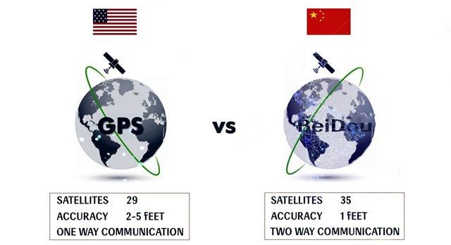
Beidou’s communication services have significantly changed how people work.
Beidou satellites can also provide handheld phone services, allowing users to make voice calls to the outside world anytime and anywhere. This is particularly useful for those who travel frequently or work in remote areas. Furthermore, Beidou’s handheld phone service can be utilized in emergency rescues and other situations to ensure immediate communication between those trapped and rescue forces.
The communication services of Beidou satellites have significantly changed how people live and work. They not only simplify the information transmission process and enhance work efficiency but also provide strong support for emergency rescue operations and disaster prevention. With the improvements in the Beidou satellite system and the ongoing expansion of application fields, it is believed that the communication services of Beidou satellites will play an increasingly important and broader role in the future.
Beidou satellites can transmit text information via a messaging service.
Disaster Monitoring and Early Warning
With the continuous development of science and technology, Beidou satellites have played a crucial role in disaster monitoring and early warning.
In terms of monitoring and early warning, the Beidou satellite system can quickly and accurately acquire real-time data through high-precision satellite positioning technology. The Beidou satellite system can receive wave data transmitted by devices and send the data to monitoring centers via the satellite network.
Monitoring centers use this data for early warnings and to send alert information to potentially affected areas in a timely manner. In this way, people can be informed of an impending earthquake a few seconds or even tens of seconds in advance, giving them enough time to take corresponding preventive measures to minimize loss of life and property.
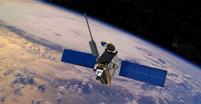
Beidou satellites can provide regulatory bodies with reliable time evidence.
Agricultural Resource Investigation and Management
Beidou satellites can monitor and track changes in agricultural land in real-time through the functionality of the Global Positioning System (GPS). By receiving satellite signals, farmers and agricultural managers can obtain accurate information such as the location, area, and shape of agricultural land, thus enabling better agricultural land use planning.
For example, in land consolidation, the Beidou satellite system can quickly outline the boundaries of all agricultural land, avoiding the tediousness and errors of traditional measurements. Beidou satellites can also assist farmers in monitoring key indicators such as soil moisture, temperature, and nutrient content, providing a scientific basis for reasonable fertilization, irrigation, and crop management.
- You visit a friend’s house and discover a “mountain of gold and silver worth over 100 billion”: Before you can celebrate, a long-standing friendship is strained!
- Stunning 4,000-year-old city emerges in the Arabian Desert
- Mysterious inhabitants in space PRC 1 – A satellite designed to last only 20 days but survives for over 50 years


