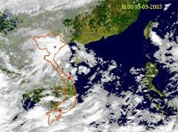
 The project to implement the use of Formosat-2 satellite data for research in the coastal areas of Southern Vietnam has recently been accepted and funded by the international project “Application of Satellites in the Knowledge Economy” (led by the Marine Resource Conservation Working Group – MRCWG).
According to Mr. Nguyen Phi Khứ from the Institute of Applied Mechanics under the Vietnam Academy of Science and Technology, the project will utilize Formosat-2 satellite imagery technology to study: assessing coastal pollution caused by oil spills and land-based waste discharges; planning and managing mangrove forests and ecotourism; modeling waves, currents, and the spread of pollution along the coastline; monitoring oceanographic meteorology, supervising coastal natural disasters, particularly coastal erosion; and training personnel for related sectors.
Mr. Khứ also mentioned that the data collection area for Formosat-2 satellite imagery spans approximately 24×160 km, covering the satellite’s scanning range from Can Gio (Ho Chi Minh City) to Can Tho. Satellite images, valued at about 3,800 USD each, will be collected daily, continuously for three years.
QUOC THANH


